File:Bahnstrecke Schongau-Peißenberg.png
Jump to navigation
Jump to search
Size of this preview: 800 × 458 pixels. Other resolutions: 320 × 183 pixels | 640 × 366 pixels | 1,024 × 586 pixels | 1,280 × 732 pixels | 1,881 × 1,076 pixels.
Original file (1,881 × 1,076 pixels, file size: 1.33 MB, MIME type: image/png)
Captions
Captions
Add a one-line explanation of what this file represents
Summary[edit]
| Description |
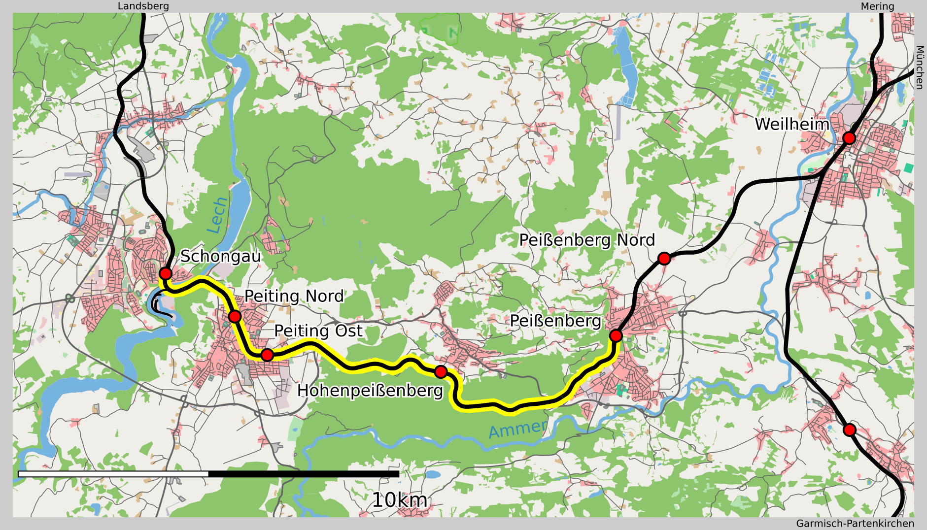
English: This map of the Schongau-Peißenberg railway was created from OpenStreetMap project data, collected by the community. This map may be incomplete, and may contain errors. Don't rely solely on it for navigation. |
| Date | see file history |
| Source | OpenStreetMap data exported and adapted by myself |
| Author |
|
| Permission (Reusing this file) |
This file is licensed under the Creative Commons Attribution-Share Alike 2.0 Generic license.
|
File history
Click on a date/time to view the file as it appeared at that time.
| Date/Time | Thumbnail | Dimensions | User | Comment | |
|---|---|---|---|---|---|
| current | 19:52, 17 February 2019 | | 1,881 × 1,076 (1.33 MB) | Vuxi (talk | contribs) | {{Information |Description={{en|This map of the Schongau-Peißenberg railway was created from OpenStreetMap project data, collected by the community.<br/><small>This map may be incomplete, and may contain errors. Don't rely solely on it for navigation.</small>}} {{de|Karte der Bahnstrecke Schongau–Peißenberg basierend auf OpenStreetMap}} |Source=OpenStreetMap data exported and adapted by myself |Date=see file history |Author=*map by OpenStree... |
You cannot overwrite this file.
File usage on Commons
The following 4 pages use this file:
File usage on other wikis
The following other wikis use this file:
- Usage on de.wikipedia.org