File:Athlone - Norman Castle (2718875972).jpg
Original file (5,616 × 3,744 pixels, file size: 7.13 MB, MIME type: image/jpeg)
Captions
Captions
Summary[edit]
.jpg&action=edit§ion=1)
| Description |
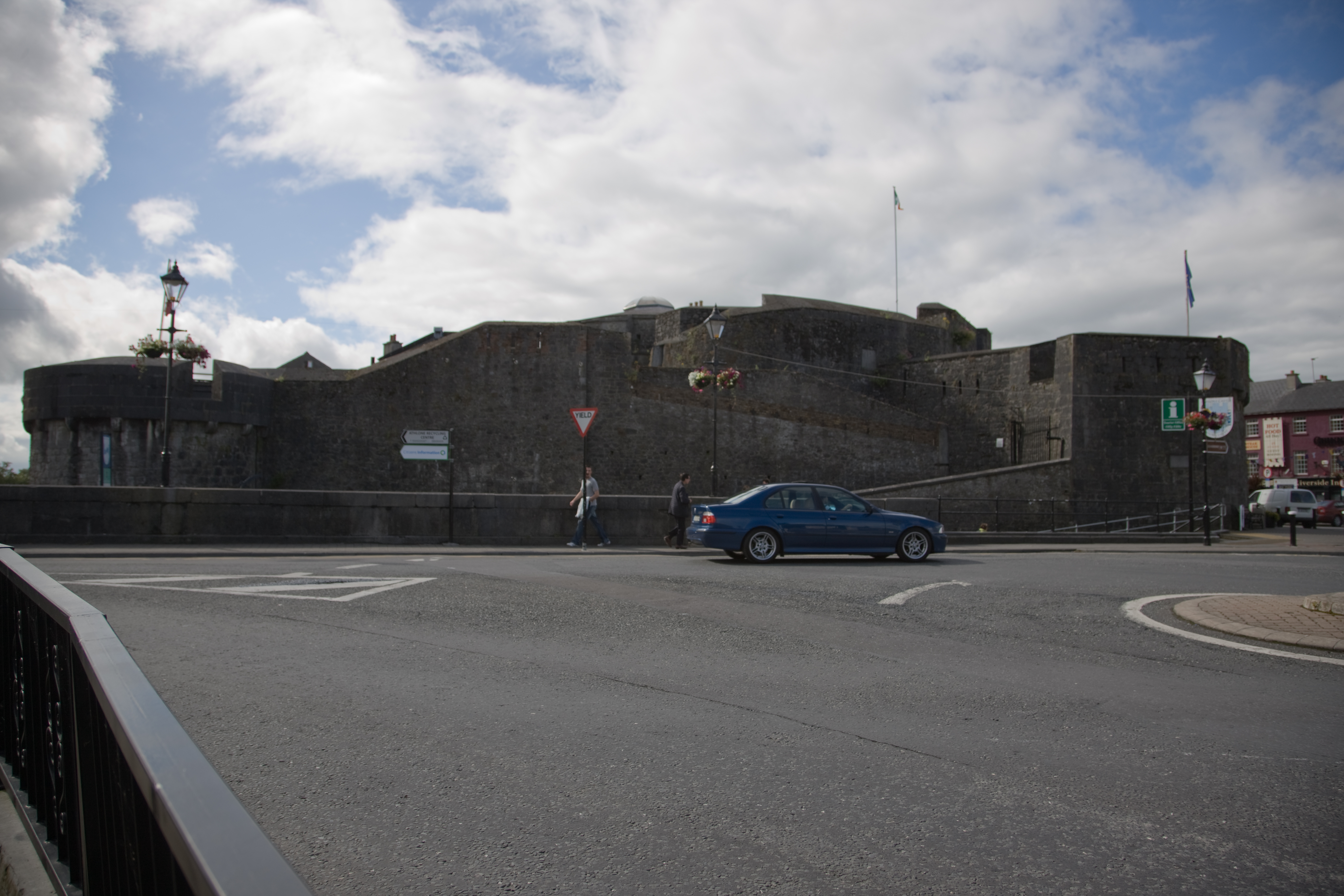
At the heart of Athlone, both geographically and historically, is the castle. The ford of Athlone was strategically important, as south of Athlone the Shannon is impassable until Clonmacnoise (where the Esker Riada meets the Shannon), and north is Lough Ree. In 1001 Brian Bóru led his army from Kincora into the town, his fleet sailing up the river via Lough Derg to attend a gathering. A bridge was built across the river in the 12th century, approximately 100 metres south of the current bridge. To protect this a fort was constructed on the west bank in the town by Turloch Mór Ó Conor. On a number of occasions both the fort and bridge were subject to attacks, and towards the end of the 12th century the Anglo-Normans constructed a motte-and-bailey fortification here. This was superseded by a stone structure built in 1210 by Justiciar John Gray. The 12-sided donjon dates from this time. The rest of the castle was largely destroyed during the Siege of Athlone and subsequently rebuilt and enlarged. During the wars that racked Ireland in the seventeenth century, Athlone held a vital position, holding the main bridge over the River Shannon into Connacht. In the Irish Confederate Wars (1641–1653), the town was held by Irish Confederate troops until it was taken late in 1650 by Charles Coote, who attacked the town from the west, having crossed into Connacht at Sligo. Forty years later, during the Williamite war in Ireland, the town was again of central strategic importance, being one of the Jacobite strongholds on the defending their position after they had retreated west after the battle of the Boyne. At the first battle of Athlone in 1690 the Jacobite forces of Colonel Richard Grace repelled an attack by 10,000 men lead by Commander Douglas. The following year the Siege of Athlone saw a further assault in which the troops of King William III eventually prevailed against the outnumbered defenders. |
| Date | |
| Source | Athlone - Norman Castle |
| Author | William Murphy from Dublin, Ireland |
| Camera location | | View this and other nearby images on: OpenStreetMap |
|---|
.jpg¶ms=053.424111_N_-007.942257_E_globe:Earth_type:camera_alt:0_source:exif_&language=en)
Licensing[edit]
.jpg&action=edit§ion=2)
- You are free:
- to share – to copy, distribute and transmit the work
- to remix – to adapt the work
- Under the following conditions:
- attribution – You must give appropriate credit, provide a link to the license, and indicate if changes were made. You may do so in any reasonable manner, but not in any way that suggests the licensor endorses you or your use.
- share alike – If you remix, transform, or build upon the material, you must distribute your contributions under the same or compatible license as the original.
| This image was originally posted to Flickr by infomatique at https://flickr.com/photos/80824546@N00/2718875972. It was reviewed on 20 February 2022 by FlickreviewR 2 and was confirmed to be licensed under the terms of the cc-by-sa-2.0. |
File history
Click on a date/time to view the file as it appeared at that time.
| Date/Time | Thumbnail | Dimensions | User | Comment | |
|---|---|---|---|---|---|
| current | 20:54, 20 February 2022 | | 5,616 × 3,744 (7.13 MB) | SeichanGant (talk | contribs) | Transferred from Flickr via #flickr2commons |
You cannot overwrite this file.
File usage on Commons
There are no pages that use this file.
.jpg&oldid=843867813)