File:Anishinaabewaki.jpg
Jump to navigation
Jump to search

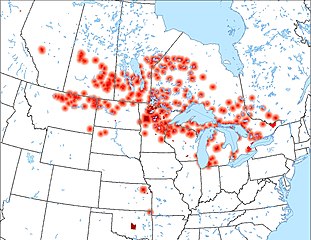
Size of this preview: 776 × 600 pixels. Other resolutions: 311 × 240 pixels | 621 × 480 pixels | 994 × 768 pixels | 1,056 × 816 pixels.
Original file (1,056 × 816 pixels, file size: 565 KB, MIME type: image/jpeg)
Captions
Captions
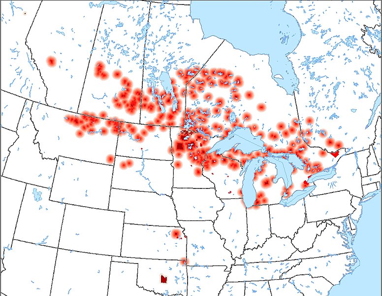
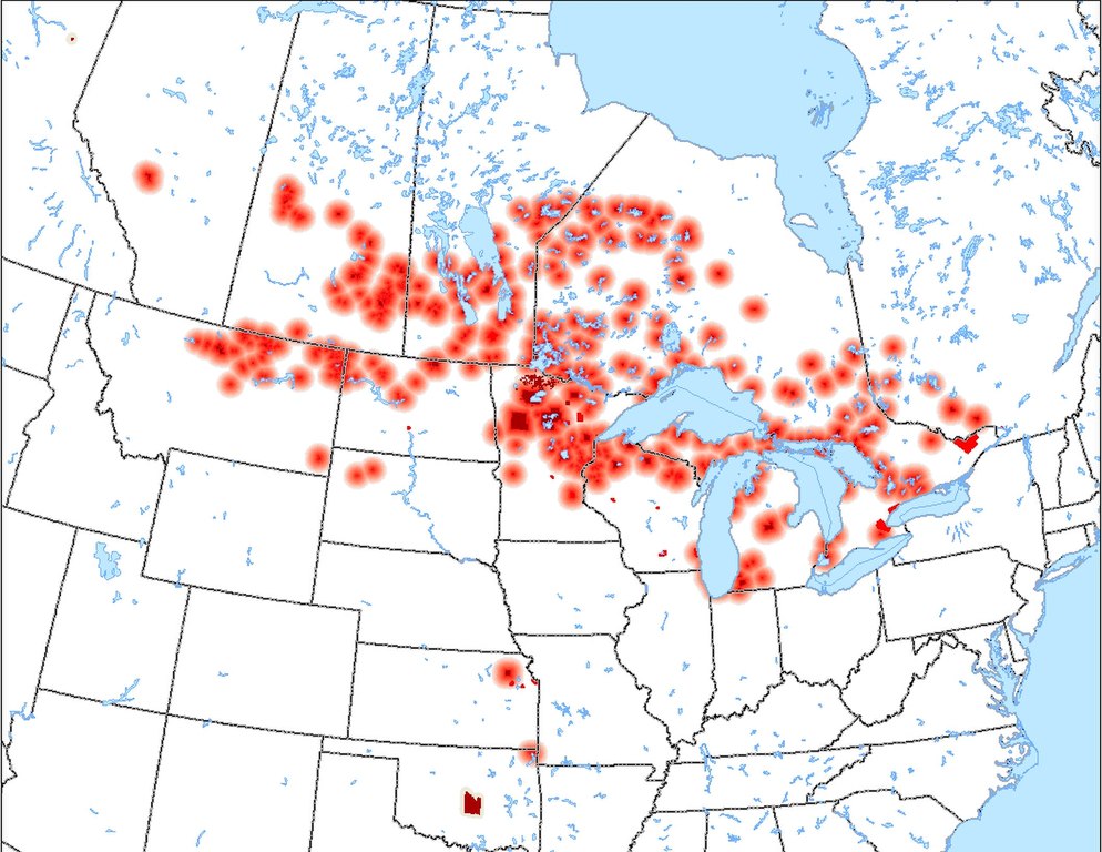
Location of all Anishinaabe Reservations/Reserves in North America
Summary[edit]
| Description |
English: Location of all Anishinaabe Reservations/Reserves in North America, with diffusion rings about communities speaking an Anishinaabe language. Cities with Anishinaabe population also shown. |
| Date | 15 April 2007 (original upload date) |
| Source | Transferred from en.wikipedia to Commons by CJLippert. |
| Author | CJLippert at English Wikipedia |
Licensing[edit]
| This work has been released into the public domain by its author, CJLippert at English Wikipedia. This applies worldwide. In some countries this may not be legally possible; if so: CJLippert grants anyone the right to use this work for any purpose, without any conditions, unless such conditions are required by law. |
Original upload log[edit]
The original description page was here. All following user names refer to en.wikipedia.
- 2007-04-18 23:27 CJLippert 1056×816×8 (578327 bytes) Error spotted in QC with the previous update. Correction made.
- 2007-04-18 23:09 CJLippert 1056×816×8 (580764 bytes) Added missed Reservations and Reserves; diffusion rings further decrease from 45-miles to 30-mile radius.
- 2007-04-17 20:14 CJLippert 1056×816×8 (629113 bytes) Diffusion rings about communities decreased from 75-mile radius to 45-mile radius; 10-mile radius ring placed about communities not speaking an Anishinaabe language for ease of seeing on the map; color of cities with Anishinaabe populations adjusted.
- 2007-04-15 21:45 CJLippert 1056×816×8 (687916 bytes) Location of all Anishinaabe Reservations/Reserves in North America, with diffusion rings about communities speaking an Anishinaabe language. Cities with Anishinaabe population also shown.
File history
Click on a date/time to view the file as it appeared at that time.
| Date/Time | Thumbnail | Dimensions | User | Comment | |
|---|---|---|---|---|---|
| current | 19:41, 27 April 2008 | | 1,056 × 816 (565 KB) | CJLippert (talk | contribs) | {{Information |Description={{en|Location of all Anishinaabe Reservations/Reserves in North America, with diffusion rings about communities speaking an Anishinaabe language. Cities with Anishinaabe population also shown.}} |Source=Transferred from [http:/ |
You cannot overwrite this file.
File usage on Commons
The following page uses this file:
File usage on other wikis
The following other wikis use this file:
- Usage on ca.wikipedia.org
- Usage on cy.wikipedia.org
- Usage on en.wikipedia.org
- Usage on eu.wikipedia.org
- Usage on fa.wikipedia.org
- Usage on fr.wikipedia.org
- Usage on gl.wikipedia.org
- Usage on id.wikipedia.org
- Usage on it.wikipedia.org
- Usage on ja.wikipedia.org
- Usage on la.wikipedia.org
- Usage on lv.wikipedia.org
- Usage on nn.wikipedia.org
- Usage on no.wikipedia.org
- Usage on pa.wikipedia.org
- Usage on qu.wikipedia.org
- Usage on ru.wikipedia.org
- Usage on th.wikipedia.org
- Usage on uk.wikipedia.org
- Usage on vi.wikipedia.org
- Usage on zh-yue.wikipedia.org
- Usage on zh.wikipedia.org
Metadata
Categories:
- Maps of Manitoba
- Maps of Ontario
- Maps of Quebec
- Maps of Saskatchewan
- Maps of Indiana
- Maps of Kansas
- Locator maps of Michigan
- Maps of Minnesota
- Linguistic maps of Montana
- Linguistic maps of North Dakota
- Linguistic maps of Oklahoma
- Locator maps of Wisconsin
- Ojibwe maps
- Linguistic maps of the Ojibwe language
- Linguistic maps of Canada
- Linguistic maps of South Dakota
- Maps of the indigenous peoples of North America