File:Al-qaim-area ar.svg
Jump to navigation
Jump to search

Size of this PNG preview of this SVG file: 429 × 328 pixels. Other resolutions: 314 × 240 pixels | 628 × 480 pixels | 1,005 × 768 pixels | 1,280 × 979 pixels | 2,560 × 1,957 pixels.
Original file (SVG file, nominally 429 × 328 pixels, file size: 450 KB)
Captions
Captions
Add a one-line explanation of what this file represents
Summary
[edit]| Description |
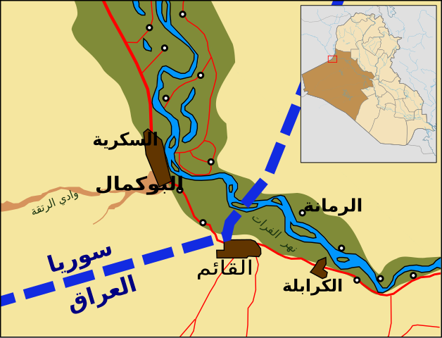
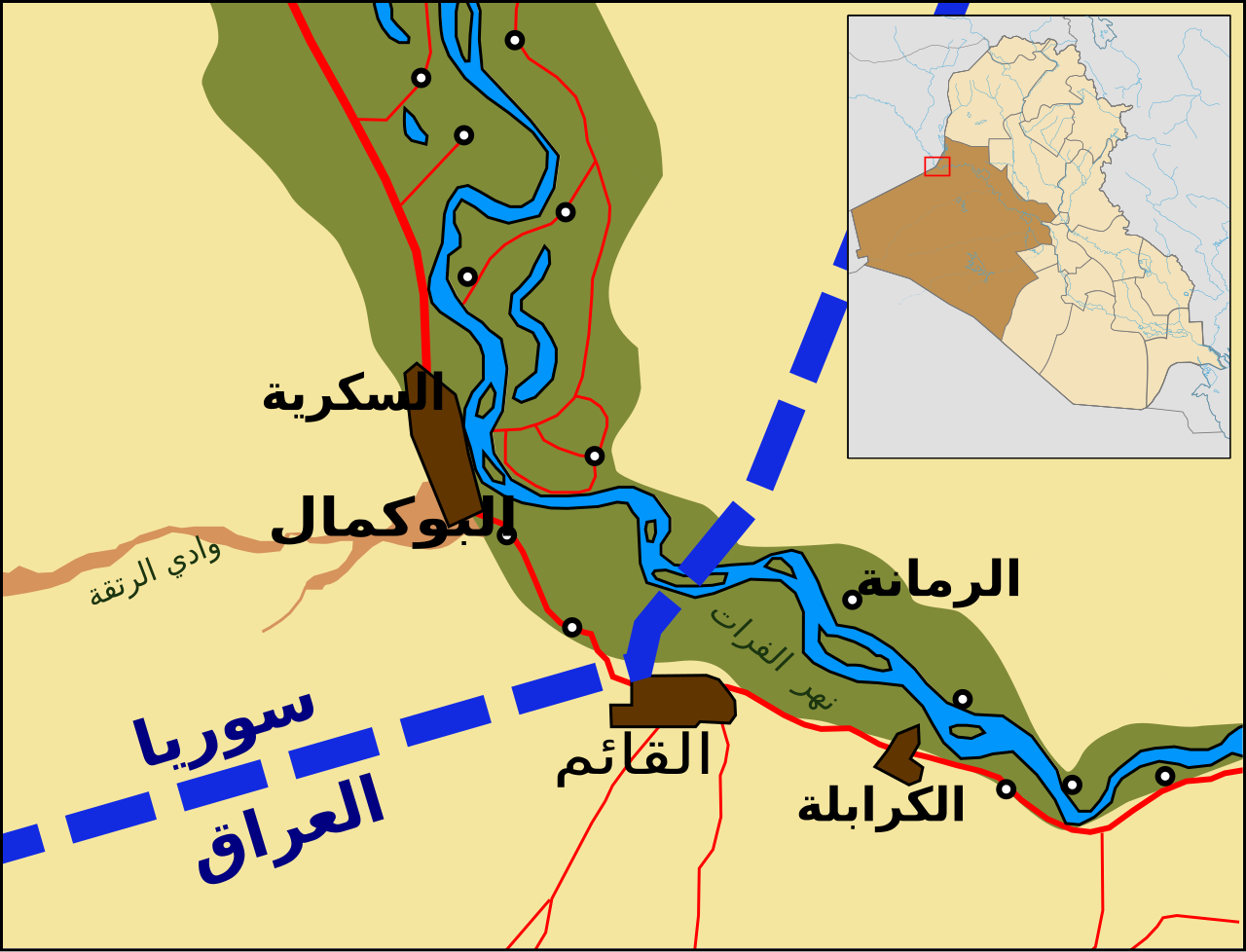
العربية: خريطة المنطقة المحيطة بمدينة القائم في العراق. بناءً على 1:500,000 جزء من وكالة رسم الخرائط الدفاعية TPC G-4C, 1991. |
| Date | |
| Source |
This file was derived from: Al-qaim-area.svg |
| Author | |
| Other versions |
|

| This is a retouched picture, which means that it has been digitally altered from its original version. Modifications: Translated to Arabic. The original can be viewed here: Al-qaim-area.svg:
|
Licensing
[edit]
| This file is made available under the Creative Commons CC0 1.0 Universal Public Domain Dedication. | |
| The person who associated a work with this deed has dedicated the work to the public domain by waiving all of their rights to the work worldwide under copyright law, including all related and neighboring rights, to the extent allowed by law. You can copy, modify, distribute and perform the work, even for commercial purposes, all without asking permission.
|
File history
Click on a date/time to view the file as it appeared at that time.
| Date/Time | Thumbnail | Dimensions | User | Comment | |
|---|---|---|---|---|---|
| current | 20:47, 21 January 2021 | | 429 × 328 (450 KB) | NANöR (talk | contribs) | Uploaded a work by *{{U|ChrisO}} *Derivative work: {{U|Nanour Garabedian}} from {{derived from|Al-qaim-area.svg}} with UploadWizard |
You cannot overwrite this file.
File usage on Commons
The following page uses this file:
File usage on other wikis
The following other wikis use this file:
- Usage on ar.wikipedia.org