File:Africa (satellite image) (cropped) Magreb.jpg
Jump to navigation
Jump to search

Size of this preview: 800 × 374 pixels. Other resolutions: 320 × 149 pixels | 640 × 299 pixels | 1,024 × 478 pixels | 1,280 × 598 pixels | 2,463 × 1,150 pixels.
Original file (2,463 × 1,150 pixels, file size: 431 KB, MIME type: image/jpeg)
Captions
Captions
Add a one-line explanation of what this file represents
| Description |
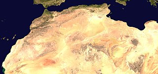
English: A composed satellite photograph of Africa. |
| Source | The image is a crop (and jpeg encoding) of the 21600 x 10800 TIFF from [1]. Care was taken to include the Azores, Cape Verde, the Arabian peninsula, and the islands immediately East off Madagascar. |
| Author | NASA |
| Other versions |
   |
.jpg)
| This file is in the public domain in the United States because it was solely created by NASA. NASA copyright policy states that "NASA material is not protected by copyright unless noted". (See Template:PD-USGov, NASA copyright policy page or JPL Image Use Policy.) | ||
 |
Warnings:
|
File history
Click on a date/time to view the file as it appeared at that time.
| Date/Time | Thumbnail | Dimensions | User | Comment | |
|---|---|---|---|---|---|
| current | 11:06, 24 May 2019 | | 2,463 × 1,150 (431 KB) | Strakhov (talk | contribs) | File:Africa (satellite image).jpg cropped 57 % horizontally, 79 % vertically using CropTool with precise mode. |
You cannot overwrite this file.
File usage on Commons
The following 2 pages use this file:
File usage on other wikis
The following other wikis use this file:
_(cropped)_Magreb.jpg&oldid=785921385)