File:Africa-asia-america-to-scale.jpg
Jump to navigation
Jump to search
Size of this preview: 800 × 267 pixels. Other resolutions: 320 × 107 pixels | 1,200 × 400 pixels.
Original file (1,200 × 400 pixels, file size: 223 KB, MIME type: image/jpeg)
Captions
Captions
Add a one-line explanation of what this file represents
| Description |
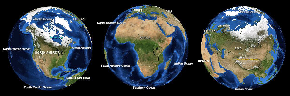
English: Three images of the Earth showing North America, Africa and Eurasia to scale. |
|||
| Date | ||||
| Source | NASA World Wind | |||
| Author | Andrew Oakley | |||
| Permission (Reusing this file) |
|

File history
Click on a date/time to view the file as it appeared at that time.
| Date/Time | Thumbnail | Dimensions | User | Comment | |
|---|---|---|---|---|---|
| current | 20:57, 4 January 2012 | 1,200 × 400 (223 KB) | Soerfm (talk | contribs) | Brightness | |
| 13:53, 13 October 2008 | 1,200 × 400 (103 KB) | Evilandi (talk | contribs) | {{Information |Description={{en|1=Three images of the Earth showing North America, Africa and Asia to scale.}} |Source=NASA World Wind |Author=Andrew Oakley |Date=2008-10-13 |Permission={{PD-WorldWind}} |other_versions= }} <!--{{ImageUpload|full}}--> |
You cannot overwrite this file.
File usage on Commons
There are no pages that use this file.
File usage on other wikis
The following other wikis use this file:
- Usage on gl.wikipedia.org
- Usage on it.wikipedia.org
- Usage on my.wikipedia.org
- Usage on os.wikipedia.org
- Usage on sa.wikipedia.org
- Usage on sd.wikipedia.org
- Usage on sw.wikipedia.org
- Usage on tr.wikipedia.org