File:Aerial View, State Route 116 and Surrounding Neighborhoods, Chicopee, Massachusetts during the Flood of 1936 - DPLA - b6ee7615ce621252dac420ed170e655d.jpg
Jump to navigation
Jump to search
Size of this preview: 777 × 599 pixels. Other resolutions: 311 × 240 pixels | 622 × 480 pixels | 996 × 768 pixels | 1,280 × 987 pixels | 2,560 × 1,975 pixels | 3,150 × 2,430 pixels.
Original file (3,150 × 2,430 pixels, file size: 920 KB, MIME type: image/jpeg)
Captions
Captions
Add a one-line explanation of what this file represents
Summary[edit]
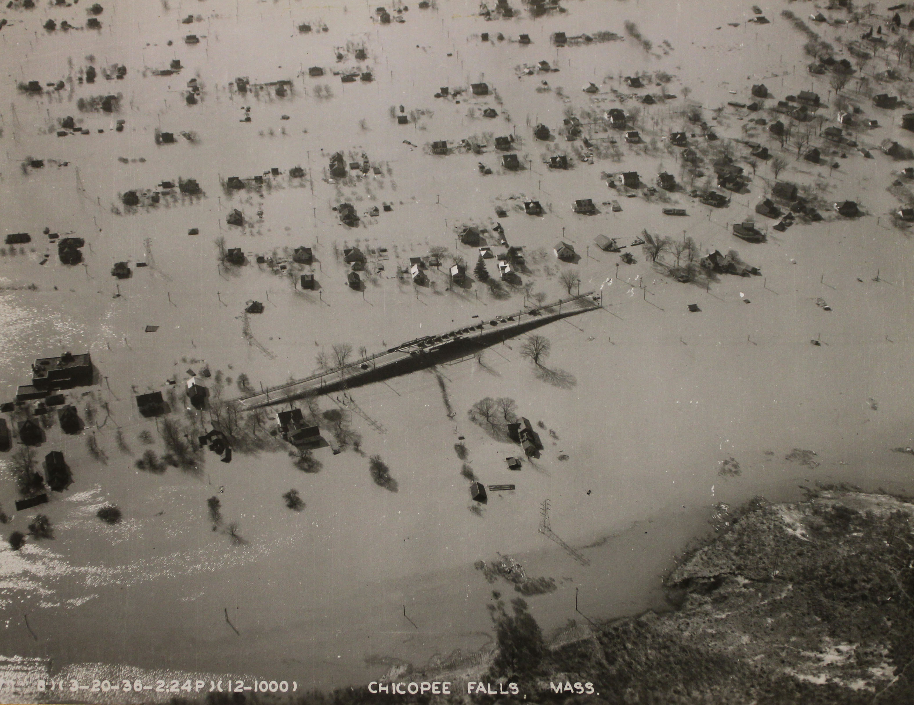
| Aerial View, State Route 116 and Surrounding Neighborhoods, Chicopee, Massachusetts during the Flood of 1936
( |
|||||||||||||||
|---|---|---|---|---|---|---|---|---|---|---|---|---|---|---|---|
| Creator | Department of Defense. Department of the Army. U.S. Army Corps of Engineers. North Atlantic Division. U.S. Army Engineer District, New England. 6/14/1979 | ||||||||||||||
| Title |
Aerial View, State Route 116 and Surrounding Neighborhoods, Chicopee, Massachusetts during the Flood of 1936 |
||||||||||||||
| Description |
Original caption: Chicopee Falls, Mass. |
||||||||||||||
| Date | 20 March 1936 | ||||||||||||||
| Collection |
|
||||||||||||||
| Source/Photographer |
|
||||||||||||||
| Permission (Reusing this file) |
|
||||||||||||||
| Standardized rights statement |
|
||||||||||||||


File history
Click on a date/time to view the file as it appeared at that time.
| Date/Time | Thumbnail | Dimensions | User | Comment | |
|---|---|---|---|---|---|
| current | 09:20, 22 November 2020 | | 3,150 × 2,430 (920 KB) | DPLA bot (talk | contribs) | Uploading DPLA ID b6ee7615ce621252dac420ed170e655d |
You cannot overwrite this file.
File usage on Commons
The following page uses this file: