File:A small Ro-Ro ferry serves residents of Ward's Island, year-round, even when the harbour is covered in ice, 2014 01 01 -a.jpg
Original file (4,320 × 3,240 pixels, file size: 5.12 MB, MIME type: image/jpeg)
Captions
Captions
Summary[edit]
| Description |
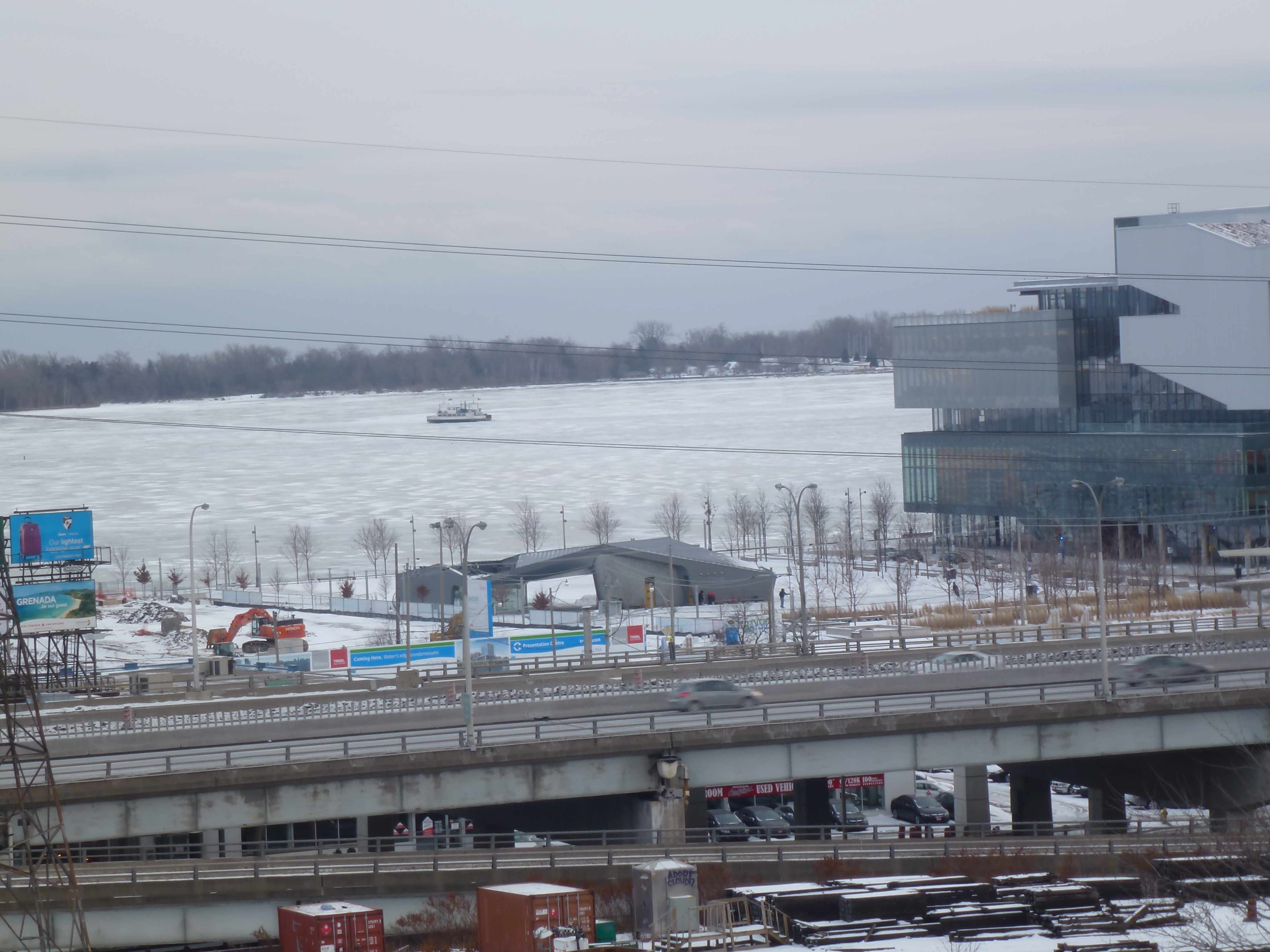
A small Ro-Ro ferry serves residents of Ward's Island, year-round, even when the harbour is covered in ice. Once most of the Toronto Islands was full of little cottages. Then most of the cottages, all but those on Ward's Island, the easternmost part of the Islands, were demolished, so there was more parkland, for recreational visitors. The occupants on Ward's Island were given long term leases, but while they allowed to winterize their cottages, and can request minor changes, like adding sleeping lofts, they can't extensively renovate or replace those cottages, which are generally less than 1000 square feet. During the summer three or four large passenger ferries carry visitors. During the winter this much smaller ferry serves the residents of Wards Island. A few days ago I took some snapshots of Toronto's main fireboat, the William Lyon Mackenzie, clearing a path through the ice, for this ferry.  |
||
| Date | |||
| Source | Frozen Toronto harbour, 4pm, 2014 01 01 (11) | ||
| Author | booledozer | ||
| Permission (Reusing this file) |
|
.jpg)
.jpg)
.jpg)
| Camera location | | View this and other nearby images on: OpenStreetMap |
|---|
Licensing[edit]
- You are free:
- to share – to copy, distribute and transmit the work
- to remix – to adapt the work
- Under the following conditions:
- attribution – You must give appropriate credit, provide a link to the license, and indicate if changes were made. You may do so in any reasonable manner, but not in any way that suggests the licensor endorses you or your use.
- share alike – If you remix, transform, or build upon the material, you must distribute your contributions under the same or compatible license as the original.
| This image was originally posted to Flickr by booledozer at https://www.flickr.com/photos/55289779@N00/11695171734. It was reviewed on 2 January 2014 by FlickreviewR and was confirmed to be licensed under the terms of the cc-by-sa-2.0. |
| Annotations | This image is annotated: View the annotations at Commons |
File history
Click on a date/time to view the file as it appeared at that time.
| Date/Time | Thumbnail | Dimensions | User | Comment | |
|---|---|---|---|---|---|
| current | 02:42, 2 January 2014 | | 4,320 × 3,240 (5.12 MB) | Geo Swan (talk | contribs) | {{Information |Description=A small Ro-Ro ferry serves residents of Ward's Island, year-round, even when the harbour is covered in ice. Once most of the Toronto Islands was full of little cottages. Then most of the cottages, all but those on Ward's Is... |
You cannot overwrite this file.
File usage on Commons
The following 2 pages use this file: