File:1928 Okeechobee Flood.png
Jump to navigation
Jump to search
Size of this preview: 626 × 600 pixels. Other resolutions: 251 × 240 pixels | 501 × 480 pixels | 855 × 819 pixels.
Original file (855 × 819 pixels, file size: 172 KB, MIME type: image/png)
Captions
Captions
Add a one-line explanation of what this file represents
Summary[edit]
| Description |
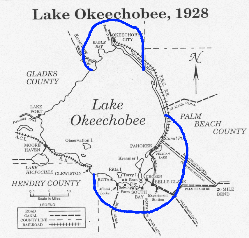
English: Map showing the area of the flood caused by the 1928 Okeechobee hurricane. Ironically, residents of Torry Island, on the south side of the lake, owe their survival to the resulting flood. Note: The Palm Beach County label is misplaced. North of Canal Point has been in Martin County since 1925. |
| Date | |
| Source | From http://www.srh.noaa.gov/mfl/newpage/Okeechobee.htm. |
| Author | NOAA |
Licensing[edit]
This image is in the public domain because it contains materials that originally came from the U.S. National Oceanic and Atmospheric Administration, taken or made as part of an employee's official duties.
|

|
This old map image could be re-created using vector graphics as an SVG file. This has several advantages; see Commons:Media for cleanup for more information. If an SVG form of this image is available, please upload it and afterwards replace this template with
{{vector version available|new image name}}.
It is recommended to name the SVG file “1928 Okeechobee Flood.svg”—then the template Vector version available (or Vva) does not need the new image name parameter. |
File history
Click on a date/time to view the file as it appeared at that time.
| Date/Time | Thumbnail | Dimensions | User | Comment | |
|---|---|---|---|---|---|
| current | 08:33, 7 October 2005 | | 855 × 819 (172 KB) | Jdorje~commonswiki (talk | contribs) | Map showing the area of the flood caused by the 1928 Okeechobee hurricane. From [http://www.srh.noaa.gov/mfl/newpage/Okeechobee.htm]. |
You cannot overwrite this file.
File usage on Commons
There are no pages that use this file.
File usage on other wikis
The following other wikis use this file:
- Usage on de.wikipedia.org
- Usage on en.wikipedia.org
- Usage on fr.wikipedia.org
- Usage on ja.wikipedia.org
- Usage on pl.wikipedia.org
- Usage on zh.wikipedia.org