File:1865 Johnson Map of Georgia and Alabama - Geographicus - GeorgiaAlabama-johnson-1865.jpg
Jump to navigation
Jump to search
Size of this preview: 800 × 574 pixels. Other resolutions: 320 × 229 pixels | 640 × 459 pixels | 1,024 × 734 pixels | 1,280 × 918 pixels | 2,560 × 1,836 pixels | 4,000 × 2,868 pixels.
Original file (4,000 × 2,868 pixels, file size: 3.96 MB, MIME type: image/jpeg)
Captions
Captions
Add a one-line explanation of what this file represents
| Artist |
|
||||||||||||||||||||||
| Title |
Johnson, A. J., Johnson's New Illustrated Family Atlas of The World with Physical Geography, and with Descriptions Geographical, Statistical, and Historic including The Latest Federal Census, A Geographical Index, and a Chronological History of the Civil War in America<-i>, (last Johnson and Ward), 1865. |
||||||||||||||||||||||
| Description |
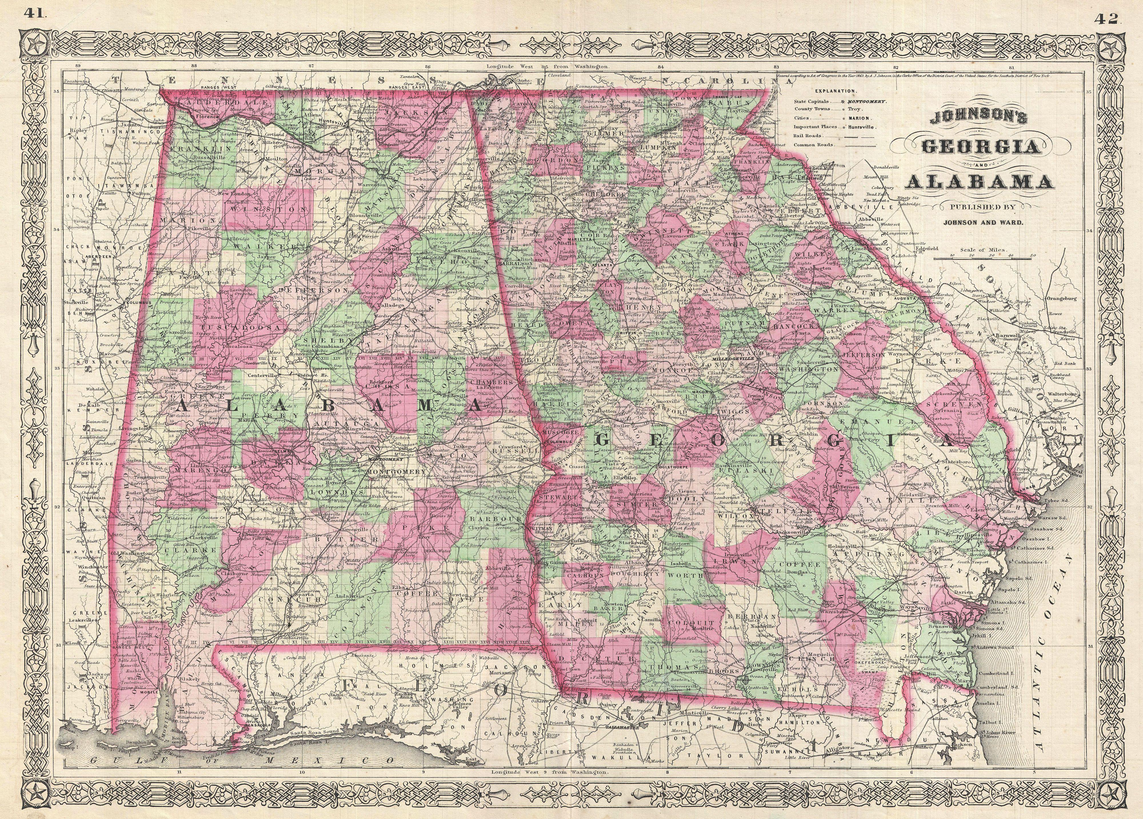
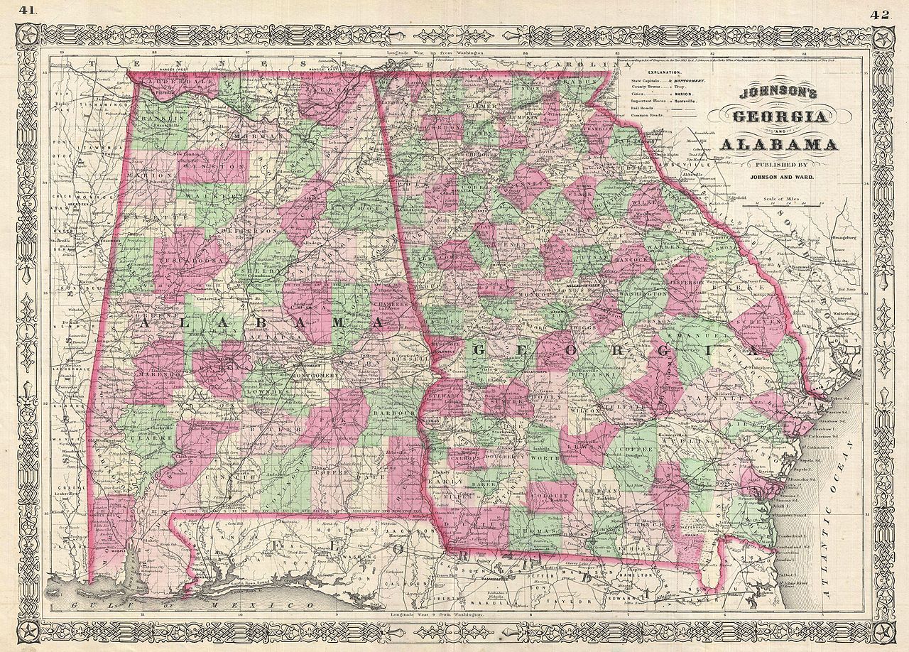
English: This is A. J. Johnson’s beautifully hand colored 1865 map of Georgia and Alabama. This map shows cities, topographical features, railways, ferries and roads with color coding at the county level. Published by A. J. Johnson and Ward as plates 41-42 in the 1865 edition of Johnson’s New Illustrated Family Atlas . |
||||||||||||||||||||||
| Date | 1865 (undated) | ||||||||||||||||||||||
| Dimensions | height: 16.5 in (41.9 cm); width: 22.5 in (57.1 cm) | ||||||||||||||||||||||
| Accession number |
Geographicus link: GeorgiaAlabama-johnson-1865 |
||||||||||||||||||||||
| Source/Photographer |
|
||||||||||||||||||||||
| Permission (Reusing this file) |
|
||||||||||||||||||||||
File history
Click on a date/time to view the file as it appeared at that time.
| Date/Time | Thumbnail | Dimensions | User | Comment | |
|---|---|---|---|---|---|
| current | 06:26, 25 March 2011 | | 4,000 × 2,868 (3.96 MB) | BotMultichillT (talk | contribs) | {{subst:User:Multichill/Geographicus |link=http://www.geographicus.com/P/AntiqueMap/GeorgiaAlabama-johnson-1865 |product_name=1865 Johnson Map of Georgia and Alabama |map_title=Johnson, A. J., <i>Johnson's New Illustrated Family Atlas of The World with Ph |
You cannot overwrite this file.
File usage on Commons
The following page uses this file: