File:1848 Map of Alabama counties.jpeg
Jump to navigation
Jump to search
Size of this preview: 472 × 599 pixels. Other resolutions: 189 × 240 pixels | 378 × 480 pixels | 605 × 768 pixels | 807 × 1,024 pixels | 2,267 × 2,876 pixels.
Original file (2,267 × 2,876 pixels, file size: 1.06 MB, MIME type: image/jpeg)
Captions
Captions
Add a one-line explanation of what this file represents
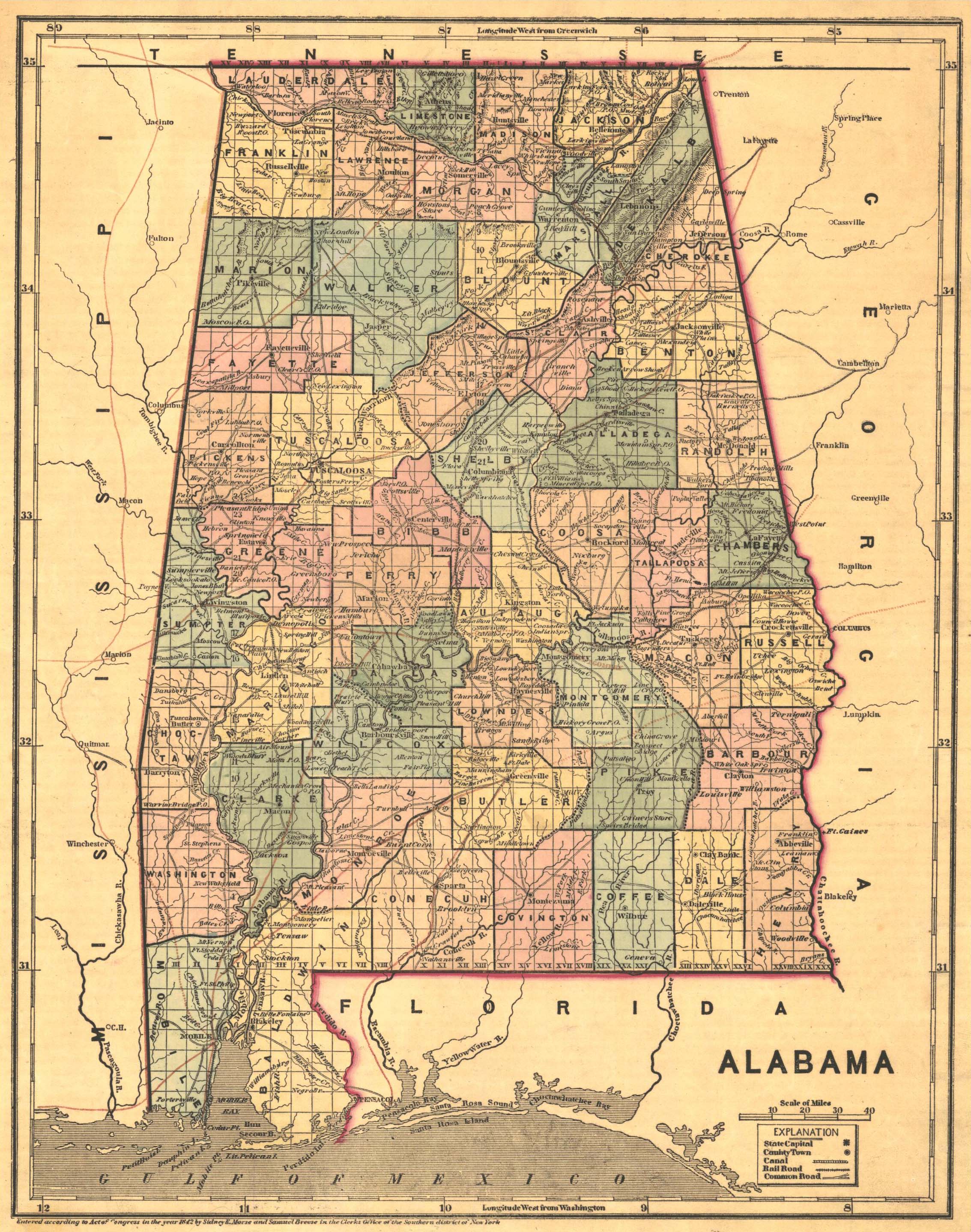
| Description | "Alabama", showing county boundaries | ||||
| Date | |||||
| Source | Historical Maps of Alabama collection, University of Alabama Department of Geography | ||||
| Author | Sidney Edward Morse | ||||
| Permission (Reusing this file) |
|
||||
File history
Click on a date/time to view the file as it appeared at that time.
| Date/Time | Thumbnail | Dimensions | User | Comment | |
|---|---|---|---|---|---|
| current | 22:03, 29 June 2009 | | 2,267 × 2,876 (1.06 MB) | Spyder Monkey (talk | contribs) | {{Information |Description="Alabama", showing county boundaries |Source=[http://alabamamaps.ua.edu/historicalmaps/alabama/1825-1850.html Historical Maps of Alabama collection], University of Alabama Department of Geography |Date=1848 |Author=Sidney Edward |
You cannot overwrite this file.
File usage on Commons
There are no pages that use this file.