File:1819 Map of Province of Kumaon by Webb.jpg
Jump to navigation
Jump to search

Size of this preview: 581 × 600 pixels. Other resolutions: 232 × 240 pixels | 465 × 480 pixels | 744 × 768 pixels | 992 × 1,024 pixels | 1,984 × 2,048 pixels | 19,472 × 20,100 pixels.
Original file (19,472 × 20,100 pixels, file size: 19.08 MB, MIME type: image/jpeg)
Captions
Captions
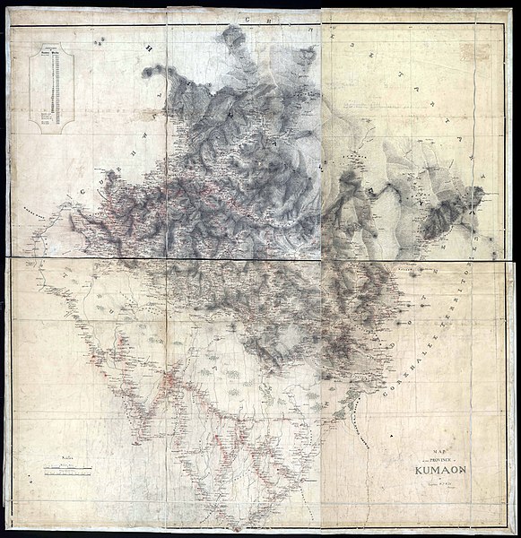
Map of the province of Kumaon by W. J. Webb, 1819
Summary[edit]
| Warning | The original file is very high-resolution. It might not load properly or could cause your browser to freeze when opened at full size. |
|---|
| Description |
English: Digital copy of the first survey map of Kumaon by the original surveyor, Captain W. J. Webb, published by The National Archieves of India, New Delhi. Catalogue of Historical maps of Survey of India (1700-1900) contains the original map of webb including other 7949 maps. |
| Date | |
| Source | http://pahar.in/indian-subcontinent-pre-1899/, https://zenodo.org/record/3596387/files/F28-31%20Map%20of%20Province%20of%20Kumaon%20by%20Webb.jpg?download=1 |
| Author | Captain W. J. Webb |
| Other versions | File:F28-32 1829 Map of the Province of Kumaon by Webb.jpg |
Licensing[edit]
|
This work is in the public domain in its country of origin and other countries and areas where the copyright term is the author's life plus 70 years or fewer. This work is in the public domain in the United States because it was published (or registered with the U.S. Copyright Office) before January 1, 1929. | |
| This file has been identified as being free of known restrictions under copyright law, including all related and neighboring rights. | |
File history
Click on a date/time to view the file as it appeared at that time.
| Date/Time | Thumbnail | Dimensions | User | Comment | |
|---|---|---|---|---|---|
| current | 16:49, 30 May 2020 | | 19,472 × 20,100 (19.08 MB) | Kautilya3 (talk | contribs) | Uploaded a work by Captain W. J. Webb from http://pahar.in/indian-subcontinent-pre-1899/ with UploadWizard |
You cannot overwrite this file.
File usage on Commons
There are no pages that use this file.
File usage on other wikis
The following other wikis use this file:
- Usage on en.wikipedia.org