File:1747 Homann Heirs Map of Belgium and the Netherlands - Geographicus - BelgiiUniversi-homannheirs-1747.jpg
Jump to navigation
Jump to search
Size of this preview: 660 × 600 pixels. Other resolutions: 264 × 240 pixels | 528 × 480 pixels | 845 × 768 pixels | 1,127 × 1,024 pixels | 2,254 × 2,048 pixels | 4,000 × 3,634 pixels.
Original file (4,000 × 3,634 pixels, file size: 4.01 MB, MIME type: image/jpeg)
Captions
Captions
Add a one-line explanation of what this file represents
| Artist | ||||||
| Title |
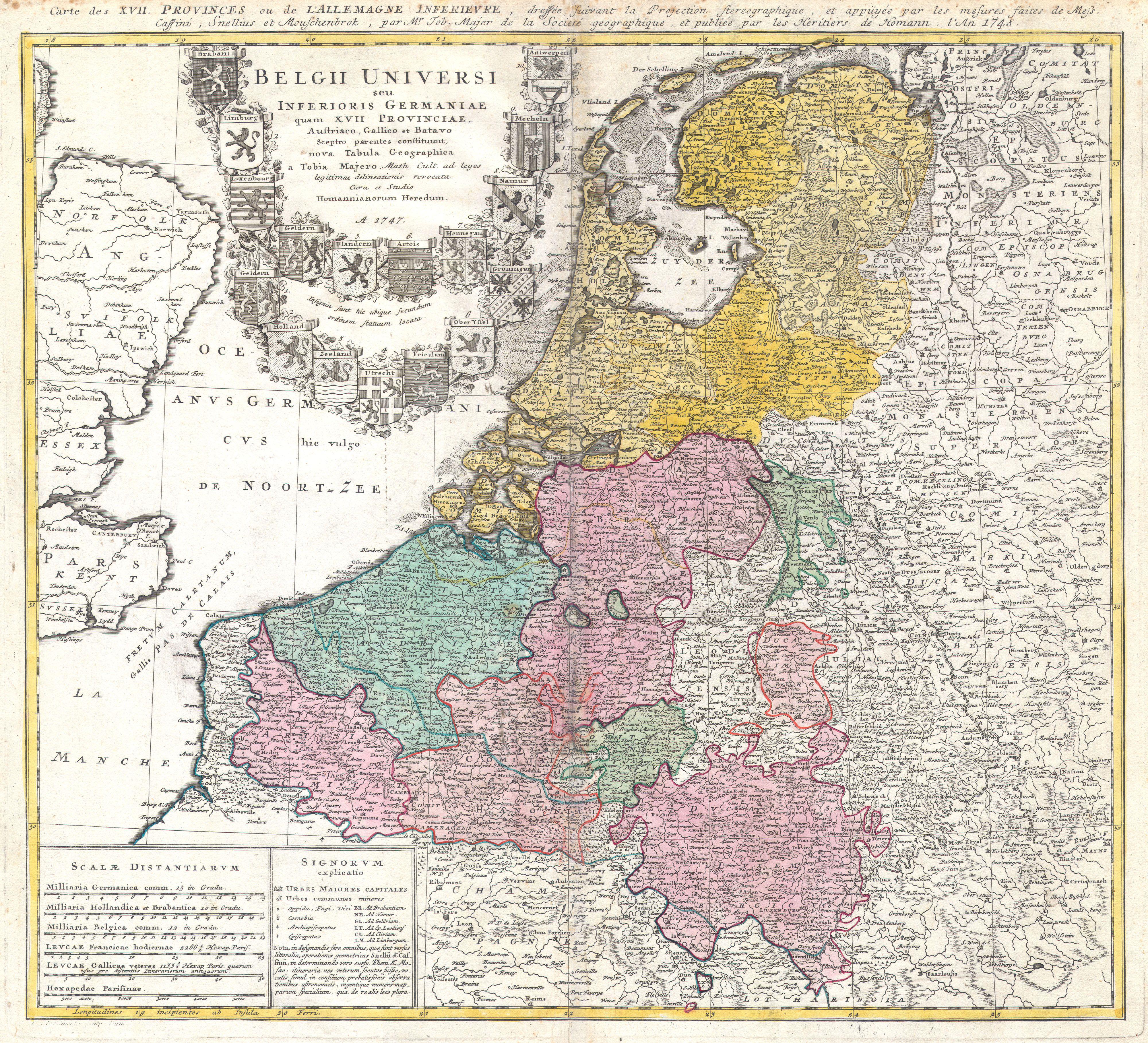
Belgii Universi seu Inferioris Germaniae quam XVII Provinciae Austriaco, Gallico et Batavo sceptro parentes constituunt nova Tabula Geographica a Tobia Majero Math. Cult. ad leges legitimae delineationis revocata Cura et studio Homanniorum Heredum A. 1747. |
|||||
| Description |
English: A beautifully detailed 1747 Homann Heirs map of Belgium and the Netherlands (Holland). Includes Belgilum proper as well as the seven states of the Belgian Federation – what is today Holland or the Netherlands. Also includes parts of England and extends into eastern Germany past the Rhine River. Title elaborate cartouche in the upper left quadrant, filling the North Sea, features the armorial shields of the Belgian Counties as well as those of the seven states of the federation: Geldern, Holland, Zeeland, Utrecht, Friesland, Ober Issel, and Groningen. Alternate title in French outside of upper margin. This map was drawn by Johann Tobias Mayer for inclusion the 1752 Homann Heirs Maior Atlas Scholasticus ex Triginta Sex Generalibus et Specialibus…. Most early Homann atlases were “made to order” or compiled of individual maps at the request of the buyer. However, this rare atlas, composed of 37 maps and charts, was issued as a “suggested collection” of essential Homann Heirs maps. |
|||||
| Date | 1747 | |||||
| Dimensions | height: 19.5 in (49.5 cm); width: 21 in (53.3 cm) | |||||
| Accession number |
Geographicus link: BelgiiUniversi-homannheirs-1747 |
|||||
| Source/Photographer |
|
|||||
| Permission (Reusing this file) |
|
|||||
File history
Click on a date/time to view the file as it appeared at that time.
| Date/Time | Thumbnail | Dimensions | User | Comment | |
|---|---|---|---|---|---|
| current | 20:32, 24 March 2011 | | 4,000 × 3,634 (4.01 MB) | BotMultichillT (talk | contribs) | {{subst:User:Multichill/Geographicus |link=http://www.geographicus.com/P/AntiqueMap/BelgiiUniversi-homannheirs-1747 |product_name=1747 Homann Heirs Map of Belgium and the Netherlands |map_title=Belgii Universi seu Inferioris Germaniae quam XVII Provinciae |
You cannot overwrite this file.
File usage on Commons
The following 2 pages use this file: