File:Arethusa-Storm-Mist-Highwood-aerial.JPG
Jump to navigation
Jump to search
Size of this preview: 800 × 600 pixels. Other resolutions: 320 × 240 pixels | 640 × 480 pixels | 1,024 × 768 pixels | 1,280 × 960 pixels | 2,272 × 1,704 pixels.
Original file (2,272 × 1,704 pixels, file size: 1.63 MB, MIME type: image/jpeg)
Captions
Captions
Add a one-line explanation of what this file represents
Summary
[edit]
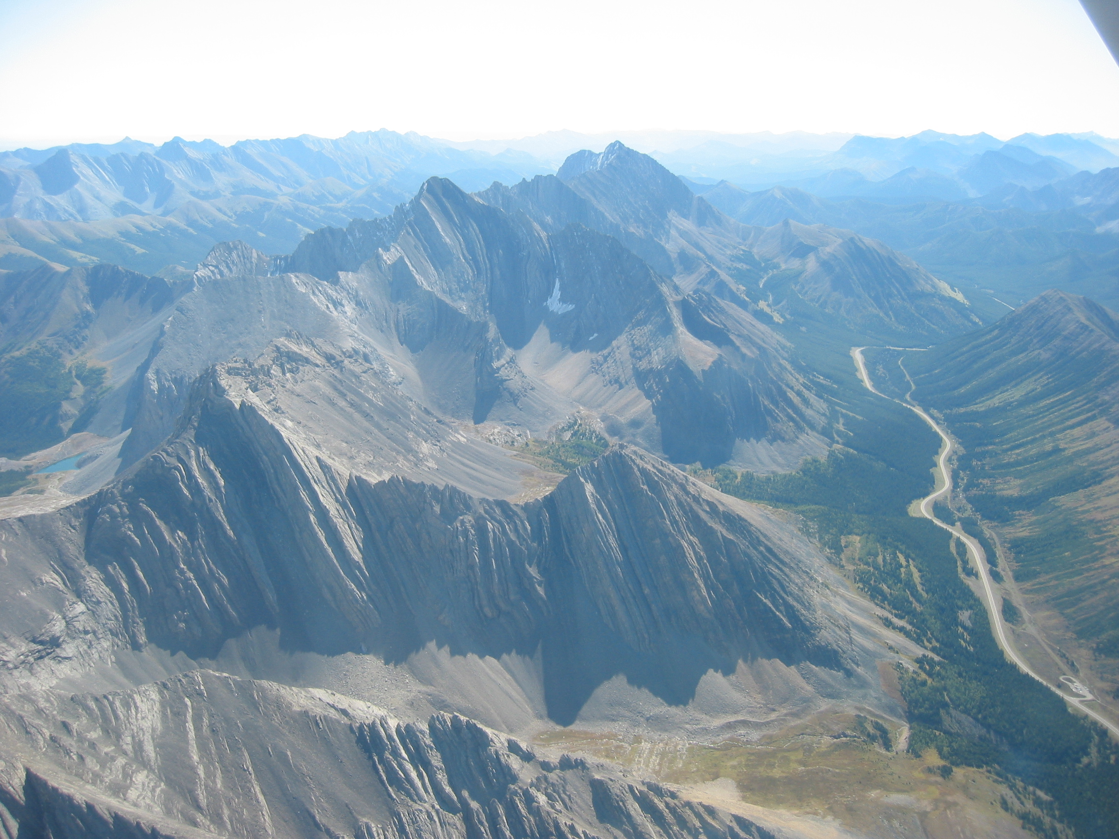
This photo was taken looking South from over the part of Mount Rae closest to the highway near Elbow Pass. Probably directly east of the Rock Glacier point of interest.
In the foreground you can see the Ptarmigan cirque and the Highwood Pass parking lot on Hwy 40. Mount Arethusa (2912m/9554') and Little Arethusa are just behind (South of) the Ptarmigan cirque. Strom Mountain is next (3095m/10153') with [Mist Mountain] (3138m/10297m) at the far end of this group.
Licensing
[edit]
This file is licensed under the Creative Commons Attribution-Share Alike 2.5 Generic license.
- You are free:
- to share – to copy, distribute and transmit the work
- to remix – to adapt the work
- Under the following conditions:
- attribution – You must give appropriate credit, provide a link to the license, and indicate if changes were made. You may do so in any reasonable manner, but not in any way that suggests the licensor endorses you or your use.
- share alike – If you remix, transform, or build upon the material, you must distribute your contributions under the same or compatible license as the original.
| Annotations | This image is annotated: View the annotations at Commons |
File history
Click on a date/time to view the file as it appeared at that time.
| Date/Time | Thumbnail | Dimensions | User | Comment | |
|---|---|---|---|---|---|
| current | 23:04, 27 September 2006 | | 2,272 × 1,704 (1.63 MB) | Kevin Lenz (talk | contribs) | In the foreground you can see the Ptarmigan cirque and the Highwood Pass parking lot on Hwy 40. Mt. Arethusa and Little Arethusa are just behind Ptarmigan cirque. Strom Mountain is next with Mist Mountain at the far end of this group. The photo was taken |
You cannot overwrite this file.
File usage on Commons
The following page uses this file:
File usage on other wikis
The following other wikis use this file:
- Usage on arz.wikipedia.org
- Usage on ceb.wikipedia.org
- Usage on en.wikipedia.org
- Usage on fr.wikipedia.org
- Usage on he.wikipedia.org
- Usage on lld.wikipedia.org
- Usage on www.wikidata.org
Metadata
Categories:
- Mountains of Alberta
- Cirques in Canada
- Glacial geomorphology of Canada
- Tilted strata in Canada
- Mount Arethusa
- Strom Mountain
- Geology of Alberta
- Aerial photographs of Alberta Highway 40
- Vertically tilted strata
- Horns (landforms) in Canada
- 2006 aerial photographs of Canada
- September 2006 in Alberta
- Mountains of Alberta (annotated)
- Mist Mountain