File:New Zealand provinces.png
Jump to navigation
Jump to search
No higher resolution available.
New_Zealand_provinces.png (405 × 590 pixels, file size: 5 KB, MIME type: image/png)
Captions
Captions
Add a one-line explanation of what this file represents
Summary
[edit]

|
This locator map image could be re-created using vector graphics as an SVG file. This has several advantages; see Commons:Media for cleanup for more information. If an SVG form of this image is available, please upload it and afterwards replace this template with
{{vector version available|new image name}}.
It is recommended to name the SVG file “New Zealand provinces.svg”—then the template Vector version available (or Vva) does not need the new image name parameter. |

|
This map has been uploaded by Electionworld from en.wikipedia.org to enable the |
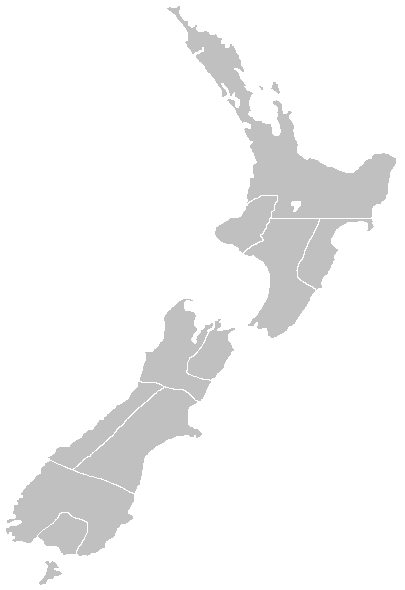
Map of the former Provinces of New Zealand, by myself.
Licensing
[edit]
I, the copyright holder of this work, hereby publish it under the following licenses:

|
Permission is granted to copy, distribute and/or modify this document under the terms of the GNU Free Documentation License, Version 1.2 or any later version published by the Free Software Foundation; with no Invariant Sections, no Front-Cover Texts, and no Back-Cover Texts. A copy of the license is included in the section entitled GNU Free Documentation License. |
| This file is licensed under the Creative Commons Attribution-Share Alike 3.0 Unported license. | ||
| ||
| This licensing tag was added to this file as part of the GFDL licensing update. |
You may select the license of your choice.
Original work by en:user:LJ Holden
derivative works
[edit]
Derivative works of this file:
- New Zealand New Munster 1846.PNG
- New Zealand provinces 1852.png
- New Zealand provinces Auckland.png
- New Zealand provinces Canterbury.png
- New Zealand provinces Hawkes Bay.png
- New Zealand province Marlborough.png
- New Zealand provinces Marlborough.png
- New Zealand provinces Nelson.png
- New Zealand provinces Otago.png
- New Zealand provinces Taranaki.png
- New Zealand provinces Wellington.png
File history
Click on a date/time to view the file as it appeared at that time.
| Date/Time | Thumbnail | Dimensions | User | Comment | |
|---|---|---|---|---|---|
| current | 23:11, 29 November 2006 | | 405 × 590 (5 KB) | Electionworld (talk | contribs) | {{ew|en||holden}} Map of the former Provinces of New Zealand, by myself. == Licensing == {{GFDL-self}} Category:Maps of New Zealand |
You cannot overwrite this file.
File usage on Commons
The following 9 pages use this file:
- Atlas of New Zealand
- File:New Zealand provinces 1852.png
- File:New Zealand provinces Auckland.png
- File:New Zealand provinces Hawkes Bay.png
- File:New Zealand provinces Marlborough.png
- File:New Zealand provinces Nelson.png
- File:New Zealand provinces Otago.png
- File:New Zealand provinces Taranaki.png
- File:New Zealand provinces Wellington.png
File usage on other wikis
The following other wikis use this file:
- Usage on en.wikibooks.org
- Usage on es.wikipedia.org
- Usage on fr.wikipedia.org
- Usage on pt.wikipedia.org
- Usage on pt.wikibooks.org