File:Mapa Canarias municipios.svg
Jump to navigation
Jump to search

Size of this PNG preview of this SVG file: 800 × 336 pixels. Other resolutions: 320 × 134 pixels | 640 × 269 pixels | 1,024 × 430 pixels | 1,280 × 537 pixels | 2,560 × 1,074 pixels | 977 × 410 pixels.
Original file (SVG file, nominally 977 × 410 pixels, file size: 111 KB)
Captions
Captions
Add a one-line explanation of what this file represents
Summary
[edit]
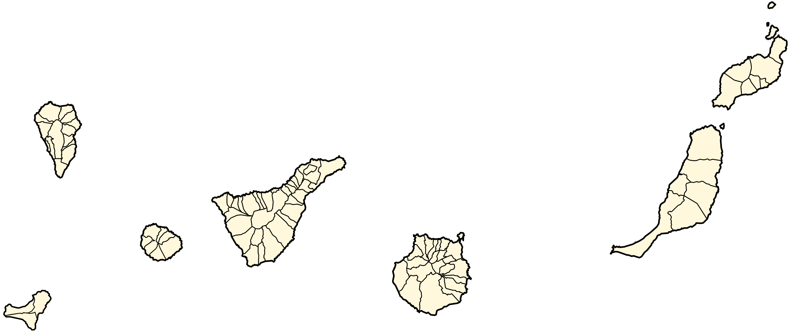
| Description | Map of the Canary Islands, showing all municipal boundaries. |
| Date | |
| Source | This document was based on Las Palmas - Mapa municipal.svg and Santa Cruz de Tenerife - Mapa municipal.svg, created by Emilio Gómez Fernández, aka Tony Rotondas |
| Author | Júlio Reis |
| Other versions | See Source above |
Licensing
[edit]
This file is licensed under the Creative Commons Attribution-Share Alike 3.0 Unported license.
- You are free:
- to share – to copy, distribute and transmit the work
- to remix – to adapt the work
- Under the following conditions:
- attribution – You must give appropriate credit, provide a link to the license, and indicate if changes were made. You may do so in any reasonable manner, but not in any way that suggests the licensor endorses you or your use.
- share alike – If you remix, transform, or build upon the material, you must distribute your contributions under the same or compatible license as the original.

|
Permission is granted to copy, distribute and/or modify this document under the terms of the GNU Free Documentation License, Version 1.2 or any later version published by the Free Software Foundation; with no Invariant Sections, no Front-Cover Texts, and no Back-Cover Texts. A copy of the license is included in the section entitled GNU Free Documentation License. |
| This file is licensed under the Creative Commons Attribution-Share Alike 3.0 Unported license. | ||
| ||
| This licensing tag was added to this file as part of the GFDL licensing update. |
File history
Click on a date/time to view the file as it appeared at that time.
| Date/Time | Thumbnail | Dimensions | User | Comment | |
|---|---|---|---|---|---|
| current | 01:53, 13 September 2007 | | 977 × 410 (111 KB) | Pepelopex (talk | contribs) | Updated to add a new municipality [[:es:El Pinar (El Hierro)|El Pinar de El Hierro (2007). Island of El Hierro. |
| 16:33, 19 July 2006 |  | 977 × 410 (108 KB) | Tintazul (talk | contribs) | colours corrected, extraneous tag deleted | |
| 16:24, 19 July 2006 |  | 977 × 410 (110 KB) | Tintazul (talk | contribs) | Category:Maps of the Canary Islands |
You cannot overwrite this file.
File usage on Commons
The following 5 pages use this file:
.svg)
File usage on other wikis
The following other wikis use this file:
- Usage on ba.wikipedia.org
- Usage on ca.wikipedia.org
- Usage on de.wikipedia.org
- Usage on es.wikipedia.org
- Usage on fr.wikipedia.org
- Usage on gl.wikipedia.org
- Usage on it.wikipedia.org
- Usage on lij.wikipedia.org
- Usage on sv.wikipedia.org
- Usage on www.wikidata.org