File:1799 Clement Cruttwell Map of Europe - Geographicus - Europe-cruttwell-1799.jpg
Jump to navigation
Jump to search

Size of this preview: 693 × 600 pixels. Other resolutions: 277 × 240 pixels | 555 × 480 pixels | 888 × 768 pixels | 1,184 × 1,024 pixels | 2,367 × 2,048 pixels | 3,500 × 3,028 pixels.
Original file (3,500 × 3,028 pixels, file size: 2.92 MB, MIME type: image/jpeg)
Captions
Captions
Add a one-line explanation of what this file represents
| Europe. | ||||||
|---|---|---|---|---|---|---|
| Artist | ||||||
| Title |
Europe. |
|||||
| Description |
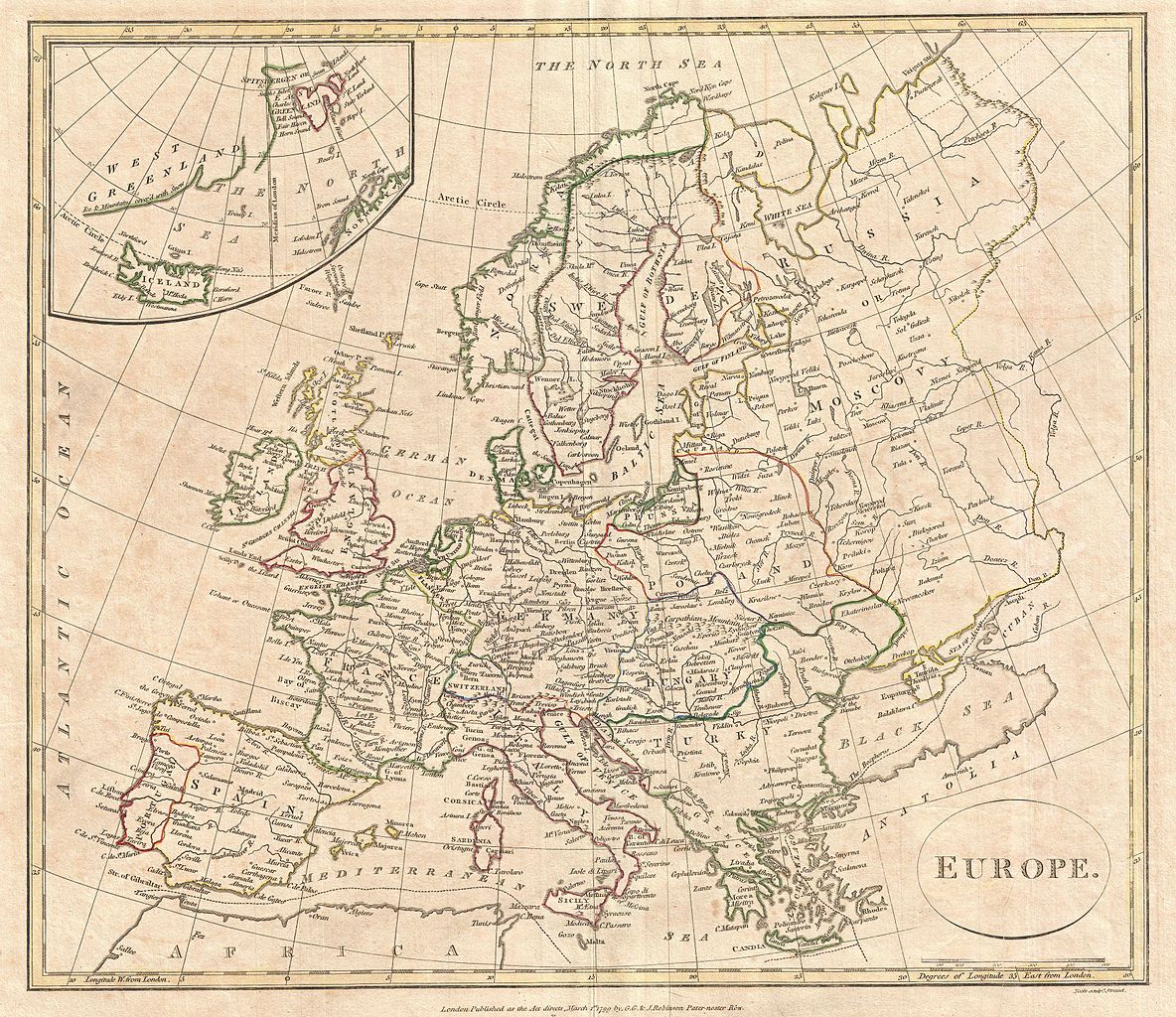
English: A fine 1799 map of Europe by the English map publisher Clement Cruttwell. Covers the entire European continent, including an very confusing inset of Greenland, Spitsbergen, and Iceland. Also includes western Russia (Muscovy) and the Black Sea. Poland is shown with its traditional boundaries though by this point it had gone through no less than three partitionings. The map is highly detailed labeling numerous cities, rivers, ports, mountains, and other topographical detail. Outline color and fine copper plate engraving in the minimalist English style prevalent in the late 18th and early 19th centuries. Drawn by G. G. and J. Robinson of Paternoster Row, London, for Clement Cruttwell's 1799 Atlas to Cruttwell's Gazetteer. |
|||||
| Date | 1799 (dated) | |||||
| Dimensions | height: 14 in (35.5 cm); width: 16 in (40.6 cm) | |||||
| Accession number |
Geographicus link: Europe-cruttwell-1799 |
|||||
| Source/Photographer |
Cruttwell, C., Atlas to Cruttwell's Gazetteer, 1799.
|
|||||
| Permission (Reusing this file) |
|
|||||
File history
Click on a date/time to view the file as it appeared at that time.
| Date/Time | Thumbnail | Dimensions | User | Comment | |
|---|---|---|---|---|---|
| current | 11:40, 24 March 2011 | | 3,500 × 3,028 (2.92 MB) | BotMultichillT (talk | contribs) | {{subst:User:Multichill/Geographicus |link=http://www.geographicus.com/P/AntiqueMap/Europe-cruttwell-1799 |product_name=1799 Clement Cruttwell Map of Europe |map_title=Europe. |description=A fine 1799 map of Europe by the English map publisher Clement Cru |
You cannot overwrite this file.
File usage on Commons
The following 2 pages use this file:
File usage on other wikis
The following other wikis use this file:
- Usage on en.wikipedia.org