Gotthardpass
(Redirected from St. Gotthard)
Esperanto: Sankt-Gotardo-Pasejo estas montpasejo en Svislando liganta la kantonojn Ticxino kaj Urio.
Deutsch: Der Gotthardpass ist ein Gebirgspass in der Schweiz, der die Kantone Tessin und Uri verbindet.
Italiano: Passo del San Gottardo è un passo alpino nella Svizzera che collega il Cantone Uri con il Cantone Ticino.
high mountain pass in Switzerland  | |||||
| Upload media | |||||
| Instance of | |||||
|---|---|---|---|---|---|
| Part of |
| ||||
| Location | |||||
| Street address |
| ||||
| Carries | |||||
| Mountain range | |||||
| Elevation above sea level |
| ||||
 | |||||
Road[edit]
Mule track[edit]
-
 old bridge
 -
 mule track
 -
 Cappella dei Morti
 -
 Cappella dei Morti
 -
 Memorial Swiss Gebirgsarmeekorps


Old road[edit]
-
 The last post carriage
 -
 Gotthard post carriage
 -
 Gotthard post carriage, 2013
 -
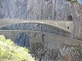 Devils bridge at the St. Gotthard pass
 -
 Devils bridge
 -
 The old street


Old road (south): Tremola[edit]
-
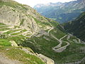 The old road on the southern side of the St. Gotthard pass
 -
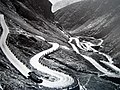 The old road (1928)
 -

-
-

-

-


New road[edit]
-
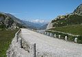
 The new road (north)
 -
 Gallery (south)
 -
 The new road (south), Airolo
 -
 Bedretto valley
 -
 New street and power pole


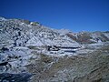
Pass, Hospiz[edit]
-
 Lago della piazza
 -
 Hospiz
 -
 Sign
Sign -
 New sign


Landscape[edit]
-
 Lake
Lake -
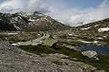 On top
 -
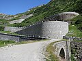
 Lucendro dam and military structures
 -
 Landscape on top
 -
 Hospiz with the Lucendro dam in the background
 -
 Lago della Sella dam
 -
 Landscape on top


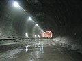
Gotthard road tunnel[edit]
-
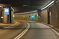 Tunnel
 -
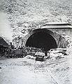
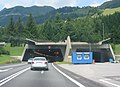 Entrace (near Airolo)


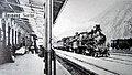
Train route[edit]
-
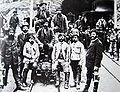
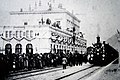 Eröffnungszug in Bellinzona
 -
-

-
 A train passing two spiral tunnels near Giornico
 -
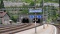 Gothard rail tunnel, entry from the Zurich side
 -
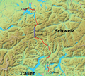 Map with Lago Maggiore in S


Construction[edit]
-
-
-

-
 Memorial for the dead workers


NEAT[edit]
-
 Route for the railway tunnel
 -
 Railway tunnels
 -
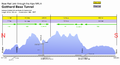 Scheme of the Gotthard Base Tunnel
 -

-

-
-

-


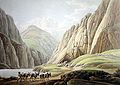
Paintings[edit]
-
 Die Gotthardpost von Rudolf Koller
 -
 Säumerkolonne Winter
 -
 Teufelsbrücke
 -
 Säumerkolonne 1790
 -

-
 Wassen 1845
 -
 Postkutsche Urnerloch
 -
 Hospiz 1785


