File:Unified Command map s.jpg
Jump to navigation
Jump to search

Size of this preview: 800 × 533 pixels. Other resolutions: 320 × 213 pixels | 640 × 426 pixels | 1,024 × 682 pixels | 1,280 × 853 pixels | 2,560 × 1,706 pixels | 4,046 × 2,696 pixels.
Original file (4,046 × 2,696 pixels, file size: 5 MB, MIME type: image/jpeg)
Captions
Captions
Add a one-line explanation of what this file represents

|
This military map image could be re-created using vector graphics as an SVG file. This has several advantages; see Commons:Media for cleanup for more information. If an SVG form of this image is available, please upload it and afterwards replace this template with
{{vector version available|new image name}}.
It is recommended to name the SVG file “Unified Command map s.svg”—then the template Vector version available (or Vva) does not need the new image name parameter. |


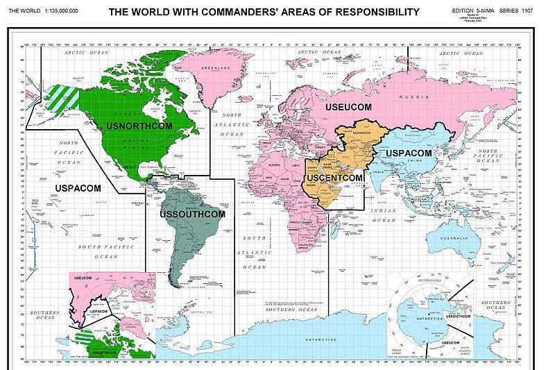
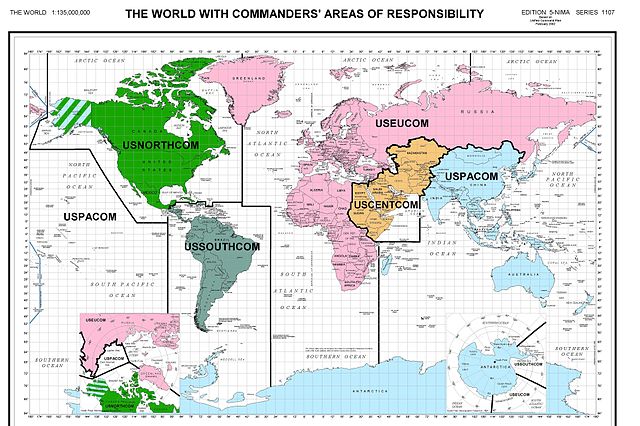
World map divided by regional Unified Commands as of April 2002- from Pentagon press release. [1].
This image is a work of a U.S. military or Department of Defense employee, taken or made as part of that person's official duties. As a work of the U.S. federal government, the image is in the public domain in the United States.
|
 |
File history
Click on a date/time to view the file as it appeared at that time.
| Date/Time | Thumbnail | Dimensions | User | Comment | |
|---|---|---|---|---|---|
| current | 14:13, 14 August 2006 | | 4,046 × 2,696 (5 MB) | Keeleysam (talk | contribs) | |
| 12:55, 3 February 2006 |  | 710 × 514 (142 KB) | GrummelJS (talk | contribs) | ||
| 20:07, 8 June 2005 |  | 437 × 283 (53 KB) | Mosesofmason (talk | contribs) | world map of divided by regional Unified Commands-public resource from pentagon website {{PD-USGov-Military}} Category:United States maps |
You cannot overwrite this file.
File usage on Commons
The following page uses this file:
File usage on other wikis
The following other wikis use this file:
- Usage on en.wikipedia.org
- Usage on fr.wikipedia.org