File:SO2.jpg
Jump to navigation
Jump to search
Size of this preview: 800 × 594 pixels. Other resolutions: 320 × 237 pixels | 640 × 475 pixels | 1,024 × 760 pixels | 1,078 × 800 pixels.
Original file (1,078 × 800 pixels, file size: 188 KB, MIME type: image/jpeg)
Captions
Captions
Add a one-line explanation of what this file represents
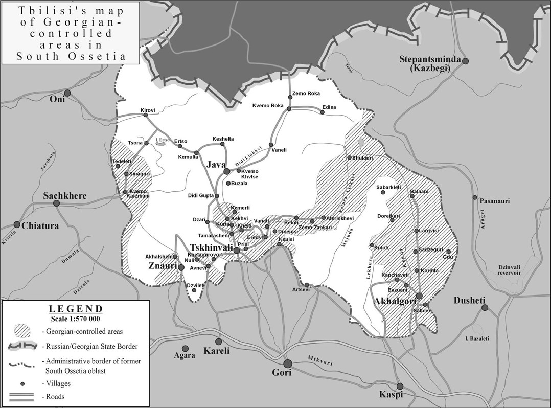
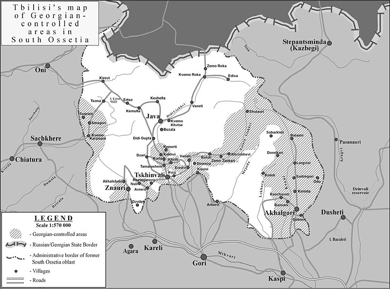
| Description | South Ossetia detailed map (zones of control according to the Georgian governmnet) |
| Date | |
| Source | International Crisis Group: [1] |
| Author | |
| Permission (Reusing this file) |
PD ("Unless otherwise specifically stated, no claim to copyright is being asserted by Crisis Group and material on this website may be freely used as in the public domain.") |
| Other versions | en:Image:SouthOssetia region detailed map.JPG |
| This work has been released into the public domain by its author, International Crisis Group. This applies worldwide. In some countries this may not be legally possible; if so: International Crisis Group grants anyone the right to use this work for any purpose, without any conditions, unless such conditions are required by law.
|
File history
Click on a date/time to view the file as it appeared at that time.
| Date/Time | Thumbnail | Dimensions | User | Comment | |
|---|---|---|---|---|---|
| current | 09:26, 10 July 2007 | | 1,078 × 800 (188 KB) | Alaexis (talk | contribs) | {{Information |Description=South Ossetia detailed map (zones of control according to the Georgian governmnet) |Source=International Crisis Group: [http://www.crisisgroup.org/home/index.cfm?id=4887&l=3] |Date=june 2007 |Permission= PD ([http://www.cris |
You cannot overwrite this file.
File usage on Commons
The following page uses this file:
File usage on other wikis
The following other wikis use this file:
- Usage on de.wikipedia.org
- Usage on el.wikipedia.org
- Usage on en.wikipedia.org
- Usage on hu.wikipedia.org
- Usage on ja.wikipedia.org
- Usage on ka.wikipedia.org
- Usage on ru.wikipedia.org
- Usage on sk.wikipedia.org
- Usage on ta.wikipedia.org
- Usage on uk.wikipedia.org
- Usage on xmf.wikipedia.org
- Usage on zh.wikipedia.org