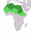
File:LocationNorthernAfrica.png
From Wikimedia Commons, the free media repository
Jump to navigation
Jump to search
LocationNorthernAfrica.png (359 × 359 pixels, file size: 8 KB, MIME type: image/png)
File information
Structured data
Captions
Captions
Add a one-line explanation of what this file represents
উত্তর আফ্রিকা
карта северной Африки
Summary[edit]
| DescriptionLocationNorthernAfrica.png |
Map: Africa – Northern Africa:
日本語: 北部アフリカの地図
|
|||||
| Date | 4 February 2006 (original upload date) | |||||
| Source | No machine-readable source provided. Own work assumed (based on copyright claims). | |||||
| Author | No machine-readable author provided. E Pluribus Anthony~commonswiki assumed (based on copyright claims). | |||||
| Other versions |
|
Licensing[edit]
| Public domainPublic domainfalsefalse |
| I, the copyright holder of this work, release this work into the public domain. This applies worldwide. In some countries this may not be legally possible; if so: I grant anyone the right to use this work for any purpose, without any conditions, unless such conditions are required by law. |
File history
Click on a date/time to view the file as it appeared at that time.
| Date/Time | Thumbnail | Dimensions | User | Comment | |
|---|---|---|---|---|---|
| current | 13:16, 11 November 2022 |  | 359 × 359 (8 KB) | ColorfulSmoke (talk | contribs) | . |
| 11:54, 11 November 2022 |  | 360 × 359 (8 KB) | ColorfulSmoke (talk | contribs) | ||
| 16:57, 17 March 2018 |  | 360 × 392 (10 KB) | Maphobbyist (talk | contribs) | Montenegro border | |
| 18:19, 10 February 2014 |  | 360 × 392 (8 KB) | Knyaz-1988 (talk | contribs) | New version | |
| 05:05, 12 January 2013 |  | 360 × 392 (13 KB) | Kuohatti (talk | contribs) | Reverted to version as of 21:04, 9 July 2011. According to http://unstats.un.org/unsd/methods/m49/m49regin.htm#africa UN doesn't count South Sudan in North Africa. | |
| 12:47, 20 July 2011 |  | 360 × 392 (8 KB) | Kahusi (talk | contribs) | See http://unstats.un.org/unsd/methods/m49/m49regin.htm | |
| 21:04, 9 July 2011 |  | 360 × 392 (13 KB) | Maphobbyist (talk | contribs) | South Sudan has become independent on July 9, 2011. Sudan and South Sudan are shown with the new international border between them. | |
| 18:55, 27 May 2009 |  | 360 × 392 (14 KB) | Elmondo21st (talk | contribs) | Reverted to version as of 08:13, 11 December 2007 | |
| 18:13, 5 April 2009 |  | 360 × 392 (14 KB) | Elmondo21st (talk | contribs) | The map of the northern Africa is about 5 main countries; Morocco, Algeria, Tunisia, Libya and Egypt. The greater northern Africa includes the Sahara countries among them Sudan. | |
| 08:13, 11 December 2007 |  | 360 × 392 (14 KB) | Hoshie (talk | contribs) | added Cabinda (Angola) |
You cannot overwrite this file.
File usage on Commons
The following page uses this file:
File usage on other wikis
The following other wikis use this file:
- Usage on ace.wikipedia.org
- Usage on af.wikipedia.org
- Usage on als.wikipedia.org
- Usage on am.wikipedia.org
- Usage on ar.wikipedia.org
- ليبيا
- جيبوتي
- موريتانيا
- تونس
- السودان
- الصحراء الغربية
- أنغولا
- أوغندا
- إسبانيا
- تشاد
- النيجر
- مالي
- السنغال
- غامبيا
- غينيا بيساو
- غينيا
- سيراليون
- ليبيريا
- غانا
- توغو
- بنين
- بوركينا فاسو
- الصومال
- كينيا
- تنزانيا
- الغابون
- زامبيا
- موزمبيق
- زيمبابوي
- البرتغال
- الكاميرون
- جمهورية الكونغو الديمقراطية
- بوتسوانا
- جنوب إفريقيا
- جمهورية إفريقيا الوسطى
- جمهورية الكونغو
- سيشل
- ناميبيا
- مدغشقر
- ليسوتو
- موريشيوس
View more global usage of this file.


