File:Europe location N-IRL2.png
Jump to navigation
Jump to search
Size of this preview: 800 × 600 pixels. Other resolutions: 320 × 240 pixels | 640 × 480 pixels | 1,024 × 768 pixels | 1,280 × 960 pixels | 1,600 × 1,200 pixels.
Original file (1,600 × 1,200 pixels, file size: 772 KB, MIME type: image/png)
Captions
Captions
Add a one-line explanation of what this file represents
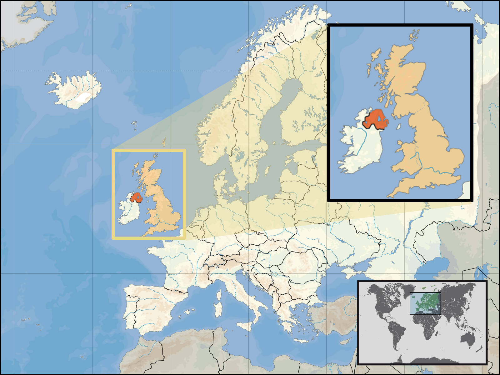
| Description | Location of Northern Ireland in the UK and Europe, on terrain map showing surface and underwater contour areas. | |||
| Date | ||||
| Source | Derived from Wikimedia Commons image of original work forming part of the "Europe location" map series created by David Liuzzo: derived from Image:Europe_location_N-IRL.png. | |||
| Author | uploaded by User:Kmusser (excerpt from User:David_Liuzzo) | |||
| Permission (Reusing this file) |
|
|||
| Other versions |
|


File history
Click on a date/time to view the file as it appeared at that time.
| Date/Time | Thumbnail | Dimensions | User | Comment | |
|---|---|---|---|---|---|
| current | 19:05, 29 September 2008 | | 1,600 × 1,200 (772 KB) | Kmusser (talk | contribs) | {{Information |Description= Location of Northern Ireland in the UK and Europe, on terrain map showing surface and underwater contour areas. |Source=Derived from Wikimedia Commons image of original work forming part of the "Europe location" map |
You cannot overwrite this file.
File usage on Commons
There are no pages that use this file.
File usage on other wikis
The following other wikis use this file:
- Usage on an.wikipedia.org
- Usage on az.wiktionary.org
- Usage on en.wikipedia.org
- Usage on eu.wiktionary.org
- Usage on fa.wikipedia.org
- Usage on fr.wikipedia.org
- Usage on gom.wikipedia.org
- Usage on gu.wikipedia.org
- Usage on gv.wikipedia.org
- Usage on id.wikipedia.org
- Usage on kn.wikipedia.org
- Usage on ko.wikipedia.org
- Usage on ml.wikipedia.org
- Usage on nds-nl.wikipedia.org
- Usage on nov.wikipedia.org
- Usage on pl.wikipedia.org
- Usage on pl.wiktionary.org
- Usage on simple.wikipedia.org
- Usage on sr.wikinews.org
- Usage on tet.wikipedia.org
- Usage on th.wikipedia.org
- Usage on tpi.wikipedia.org
- Usage on tr.wiktionary.org
- Usage on war.wikipedia.org