File:Colorado watershed.png
Jump to navigation
Jump to search
Size of this preview: 597 × 599 pixels. Other resolutions: 239 × 240 pixels | 478 × 480 pixels | 1,000 × 1,004 pixels.
Original file (1,000 × 1,004 pixels, file size: 326 KB, MIME type: image/png)
Captions
Captions
Add a one-line explanation of what this file represents
Summary[edit]
| Description |
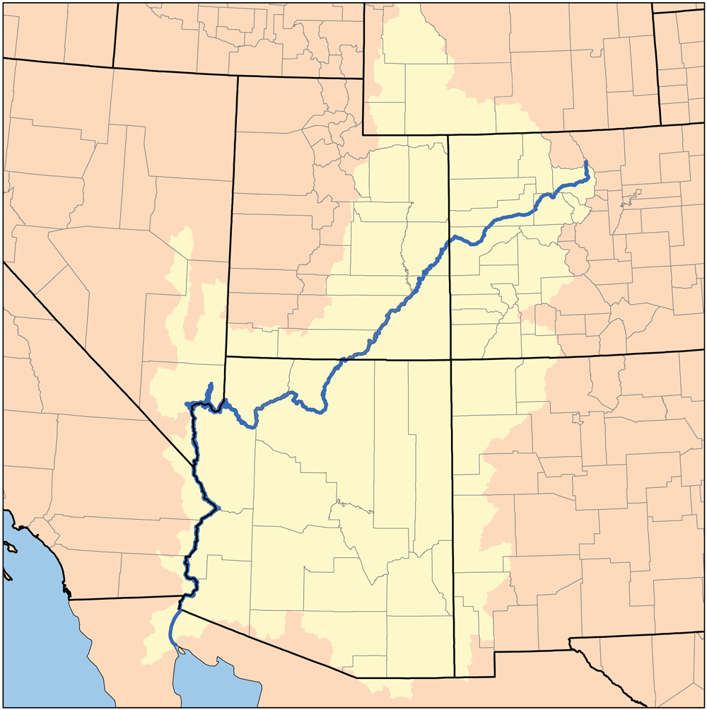
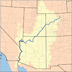
Deutsch: Karte des Verlaufs und Einzugsgebiets des Colorado River
|
| Date | 3 August 2005 (original upload date) |
| Source | No machine-readable source provided. Own work assumed (based on copyright claims). |
| Author | No machine-readable author provided. Kmusser assumed (based on copyright claims). |
Licensing[edit]
I, the copyright holder of this work, hereby publish it under the following license:
This file is licensed under the Creative Commons Attribution-Share Alike 3.0 Unported license.
- You are free:
- to share – to copy, distribute and transmit the work
- to remix – to adapt the work
- Under the following conditions:
- attribution – You must give appropriate credit, provide a link to the license, and indicate if changes were made. You may do so in any reasonable manner, but not in any way that suggests the licensor endorses you or your use.
- share alike – If you remix, transform, or build upon the material, you must distribute your contributions under the same or compatible license as the original.
File history
Click on a date/time to view the file as it appeared at that time.
| Date/Time | Thumbnail | Dimensions | User | Comment | |
|---|---|---|---|---|---|
| current | 14:02, 26 April 2010 | | 1,000 × 1,004 (326 KB) | Kmusser (talk | contribs) | fixed WY boundary, increased resolution |
| 19:16, 2 May 2007 |  | 473 × 476 (128 KB) | Kmusser (talk | contribs) | increased resolution | |
| 00:56, 2 May 2007 |  | 217 × 218 (20 KB) | DanMS (talk | contribs) | Trimmed excess white space around image and uploaded same again. | |
| 19:01, 16 November 2005 |  | 230 × 230 (19 KB) | Kmusser (talk | contribs) | ||
| 15:28, 8 September 2005 |  | 230 × 230 (48 KB) | Kmusser (talk | contribs) | ||
| 18:15, 3 August 2005 |  | 230 × 230 (23 KB) | Kmusser (talk | contribs) | This is a map of the Colorado River Watershed. I, Karl Musser, created it based on USGS data. {{GFDL}} |
You cannot overwrite this file.
File usage on Commons
The following 3 pages use this file:
File usage on other wikis
The following other wikis use this file:
- Usage on af.wikipedia.org
- Usage on ar.wikipedia.org
- Usage on azb.wikipedia.org
- Usage on be.wikipedia.org
- Usage on bg.wikipedia.org
- Usage on br.wikipedia.org
- Usage on cs.wikipedia.org
- Usage on cy.wikipedia.org
- Usage on da.wikipedia.org
- Usage on en.wikipedia.org
- Usage on eo.wikipedia.org
- Usage on et.wikipedia.org
- Usage on fr.wikipedia.org
- Usage on fy.wikipedia.org
- Usage on he.wikipedia.org
- Usage on hr.wikipedia.org
- Usage on hy.wikipedia.org
- Usage on it.wikipedia.org
- Usage on ky.wikipedia.org
- Usage on la.wikipedia.org
- Usage on lb.wikipedia.org
- Usage on nl.wikipedia.org
- Usage on nn.wikipedia.org
- Usage on no.wikipedia.org
- Usage on pl.wikipedia.org
- Usage on pl.wiktionary.org
- Usage on pms.wikipedia.org
- Usage on pt.wikipedia.org
- Usage on ro.wikipedia.org
- Usage on simple.wikipedia.org
- Usage on sw.wikipedia.org
- Usage on th.wikipedia.org
- Usage on tr.wikipedia.org
- Usage on www.wikidata.org