File:ZwarteBeek kaart OSM.png
Jump to navigation
Jump to search

Size of this preview: 800 × 569 pixels. Other resolutions: 320 × 228 pixels | 640 × 455 pixels | 1,024 × 729 pixels | 1,082 × 770 pixels.
Original file (1,082 × 770 pixels, file size: 1.07 MB, MIME type: image/png)
Captions
Captions
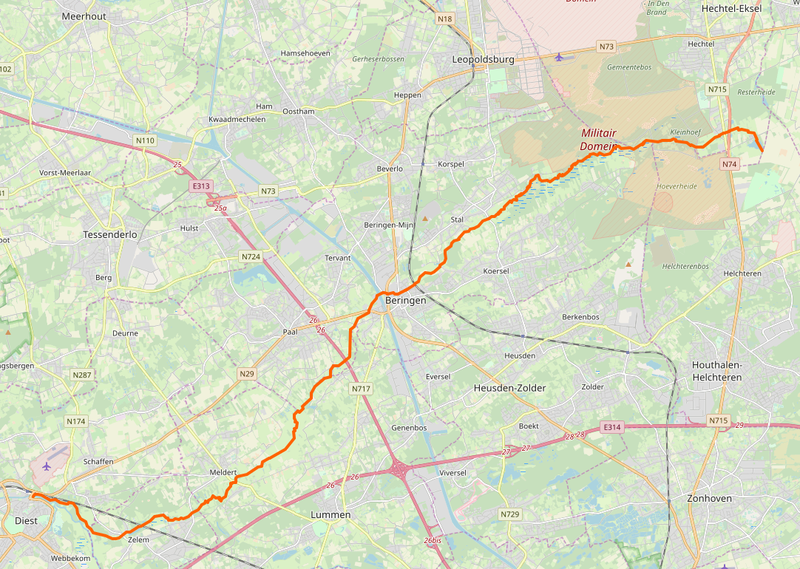
Zwarte Beek location map
Summary[edit]
| Description |
Nederlands: Kaart van de Zwarte Beek van OpenStreetMap
English: Location of a waterway Zwarte Beek in Belgium from OpenStreetMap |
| Date | |
| Source | Openstreetmap.org |
| Author | OpenStreetMap contributors |
| Permission (Reusing this file) |
© OpenStreetMap-auteurs, CC-BY-SA |
Licensing[edit]
This file is licensed under the Creative Commons Attribution-Share Alike 2.0 Generic license.
- You are free:
- to share – to copy, distribute and transmit the work
- to remix – to adapt the work
- Under the following conditions:
- attribution – You must give appropriate credit, provide a link to the license, and indicate if changes were made. You may do so in any reasonable manner, but not in any way that suggests the licensor endorses you or your use.
- share alike – If you remix, transform, or build upon the material, you must distribute your contributions under the same or compatible license as the original.
File history
Click on a date/time to view the file as it appeared at that time.
| Date/Time | Thumbnail | Dimensions | User | Comment | |
|---|---|---|---|---|---|
| current | 21:22, 8 October 2019 | | 1,082 × 770 (1.07 MB) | Eebie (talk | contribs) | User created page with UploadWizard |
You cannot overwrite this file.
File usage on Commons
The following 3 pages use this file:
File usage on other wikis
The following other wikis use this file:
- Usage on nl.wikipedia.org