File:Zion Baptist Church, outside Columbia.jpg
Jump to navigation
Jump to search

Size of this preview: 800 × 532 pixels. Other resolutions: 320 × 213 pixels | 640 × 426 pixels | 1,024 × 681 pixels | 1,280 × 851 pixels | 2,560 × 1,702 pixels | 6,016 × 4,000 pixels.
Original file (6,016 × 4,000 pixels, file size: 6.3 MB, MIME type: image/jpeg)
Captions
Captions
Add a one-line explanation of what this file represents
|
This is an image of a place or building that is listed on the National Register of Historic Places in the United States of America. Its reference number is 76000843. |
| Camera location | | View this and other nearby images on: OpenStreetMap |
|---|
| Description |
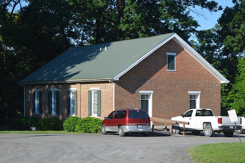
English: Front and eastern side of the former Zion Baptist Church, located at the intersection of Kentucky Routes 55 and 92 southeast of Columbia in Adair County, Kentucky, United States. Built in 1837, it is listed on the National Register of Historic Places. |
||
| Date | Taken on 20 June 2017 | ||
| Source | Own work | ||
| Author | Nyttend | ||
| Permission (Reusing this file) |
|
File history
Click on a date/time to view the file as it appeared at that time.
| Date/Time | Thumbnail | Dimensions | User | Comment | |
|---|---|---|---|---|---|
| current | 06:02, 6 July 2017 | | 6,016 × 4,000 (6.3 MB) | Nyttend (talk | contribs) | {{NRHP|76000843}} {{Location|37|3|2.5|N|85|15|44.5|W}} {{Information |Description={{en|Front and eastern side of the former {{w|Zion Meetinghouse and School|Zion Baptist Church}}, located at the intersection of Kentucky Routes {{w|Kentucky Route 55|55}... |
You cannot overwrite this file.
File usage on Commons
There are no pages that use this file.
File usage on other wikis
The following other wikis use this file:
- Usage on de.wikipedia.org
- Usage on en.wikipedia.org
- Usage on fr.wikipedia.org
- Usage on www.wikidata.org
Metadata
Categories:
- Churches in Kentucky built in 1837
- Brick churches in Adair County, Kentucky
- Former Baptist churches in Kentucky
- Kentucky Route 55
- Kentucky Route 92
- National Register of Historic Places in Adair County, Kentucky
- Zion churches in Kentucky
- June 2017 in Kentucky
- Churches in the United States photographed in 2017