File:Yorkshire and the Humber wards 2011 map coloured.svg
Jump to navigation
Jump to search

Size of this PNG preview of this SVG file: 705 × 600 pixels. Other resolutions: 282 × 240 pixels | 564 × 480 pixels | 903 × 768 pixels | 1,204 × 1,024 pixels | 2,408 × 2,048 pixels | 1,425 × 1,212 pixels.
Original file (SVG file, nominally 1,425 × 1,212 pixels, file size: 3.75 MB)
Captions
Captions
Add a one-line explanation of what this file represents
Summary[edit]
| Description |
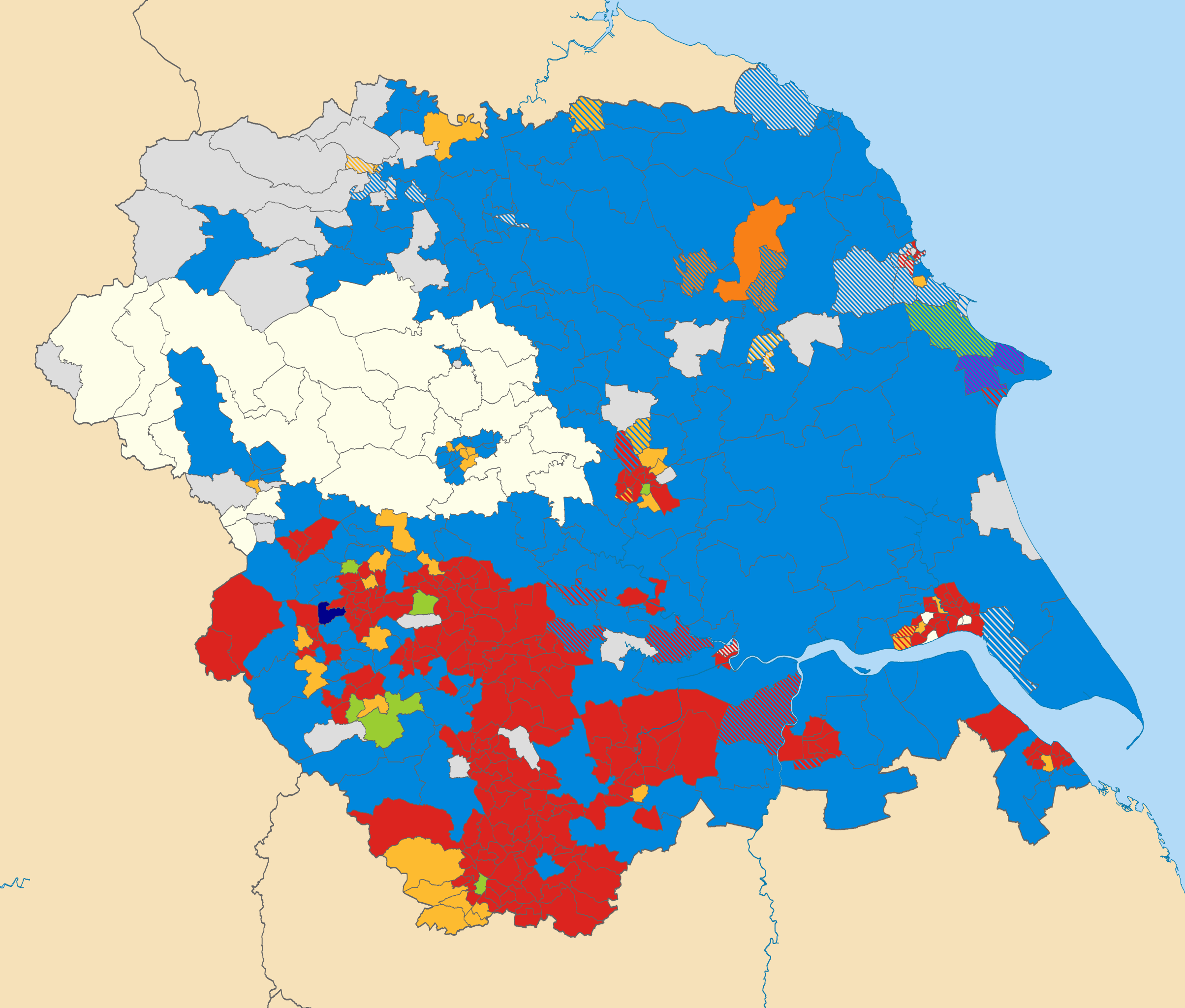
Map of the Yorkshire and the Humber region showing the electoral wards in 2011. Equirectangular map projection on WGS 84 datum, with N/S stretched 170% Geographic limits: *West: 2.65W *East: 0.25E *North: 54.65N *South: 53.2N Colours: Labour
Conservative
Liberal Democrat
Independent
Green
Liberal
British National
Social Democratic (1990-present)
Striped wards have mixed representation, and in wards that are white no elections were held. |
| Date | (UTC) |
| Source |
This file was derived from: Yorkshire and the Humber wards 2011 map.svg: |
| Author |
|
| Permission (Reusing this file) |
This file is licensed under the Creative Commons Attribution-Share Alike 3.0 Unported license. Attribution: Contains Ordnance Survey data © Crown copyright and database right
|
Original upload log[edit]
This image is a derivative work of the following images:
- File:Yorkshire_and_the_Humber_wards_2011_map.svg licensed with Cc-by-sa-3.0
- 2012-04-01T19:47:56Z Nilfanion 1425x1212 (3926698 Bytes) {{Information |Description=Map of the [[w:Yorkshire and the Humber|Yorkshire and the Humber]] region showing the electoral wards in 2011. Equirectangular map projection on WGS 84 datum, with N/S stretched 170% Geographic li
Uploaded with derivativeFX
File history
Click on a date/time to view the file as it appeared at that time.
| Date/Time | Thumbnail | Dimensions | User | Comment | |
|---|---|---|---|---|---|
| current | 12:57, 17 April 2012 | | 1,425 × 1,212 (3.75 MB) | HeadlightMorning (talk | contribs) | Fixing Ecclesall & East Ecclesfield swap. |
| 05:43, 14 April 2012 |  | 1,425 × 1,212 (3.75 MB) | HeadlightMorning (talk | contribs) | == {{int:filedesc}} == {{Information |Description=Map of the Yorkshire and the Humber region showing the electoral wards in 2011. Equirectangular map projection on WGS 84 datum, with N/S stretched 170% Geographic limits... |
You cannot overwrite this file.
File usage on Commons
There are no pages that use this file.