File:Wychavon Way approaching Church Lench - geograph.org.uk - 922085.jpg
Jump to navigation
Jump to search
No higher resolution available.
Wychavon_Way_approaching_Church_Lench_-_geograph.org.uk_-_922085.jpg (640 × 480 pixels, file size: 164 KB, MIME type: image/jpeg)
Captions
Captions
Add a one-line explanation of what this file represents
Summary[edit]
| Description |
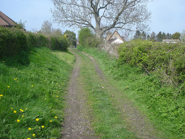
English: Wychavon Way approaching Church Lench Looking northwards along the track to the outskirts of the village. The 42-mile Wychavon Way links Holt Fleet (north of Worcester on the Severn) to the Cotswolds, passing through many pretty Vale of Evesham villages like this one, and finally linking to the Cotswold Way at Winchcombe. This gentle walking route was originally opened in 1977 to commemorate the Silver Jubilee of Elizabeth II. |
| Date | |
| Source | From geograph.org.uk |
| Author | Trevor Rickard |
| Attribution (required by the license) | Trevor Rickard / Wychavon Way approaching Church Lench / |
| Camera location | | View this and other nearby images on: OpenStreetMap |
|---|
_heading:22.00&language=en)
| Object location | | View this and other nearby images on: OpenStreetMap |
|---|
_heading:22.00&language=en)
Licensing[edit]

|
This image was taken from the Geograph project collection. See this photograph's page on the Geograph website for the photographer's contact details. The copyright on this image is owned by Trevor Rickard and is licensed for reuse under the Creative Commons Attribution-ShareAlike 2.0 license.
|
This file is licensed under the Creative Commons Attribution-Share Alike 2.0 Generic license.
Attribution: Trevor Rickard
- You are free:
- to share – to copy, distribute and transmit the work
- to remix – to adapt the work
- Under the following conditions:
- attribution – You must give appropriate credit, provide a link to the license, and indicate if changes were made. You may do so in any reasonable manner, but not in any way that suggests the licensor endorses you or your use.
- share alike – If you remix, transform, or build upon the material, you must distribute your contributions under the same or compatible license as the original.
File history
Click on a date/time to view the file as it appeared at that time.
| Date/Time | Thumbnail | Dimensions | User | Comment | |
|---|---|---|---|---|---|
| current | 04:59, 22 February 2011 | | 640 × 480 (164 KB) | GeographBot (talk | contribs) | == {{int:filedesc}} == {{Information |description={{en|1=Wychavon Way approaching Church Lench Looking northwards along the track to the outskirts of the village. The 42-mile Wychavon Way links Holt Fleet (north of Worcester on the Severn) to the Cotswold |
You cannot overwrite this file.
File usage on Commons
There are no pages that use this file.