File:Ws-map.png
Jump to navigation
Jump to search
No higher resolution available.
Ws-map.png (629 × 317 pixels, file size: 8 KB, MIME type: image/png)
Captions
Captions
Add a one-line explanation of what this file represents
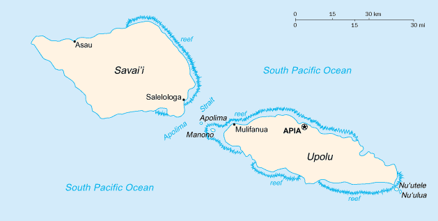
Italiano: Mappa delle Samoa

|
This map has been uploaded by Electionworld from en.wikipedia.org to enable the |
CIA map
This image is in the public domain because it contains materials that originally came from the United States Central Intelligence Agency's World Factbook.
|
 |
File history
Click on a date/time to view the file as it appeared at that time.
| Date/Time | Thumbnail | Dimensions | User | Comment | |
|---|---|---|---|---|---|
| current | 05:18, 13 February 2022 | | 629 × 317 (8 KB) | Lojwe (talk | contribs) | Cropped 1 % horizontally, 1 % vertically using CropTool with precise mode. |
| 23:20, 28 November 2006 |  | 633 × 321 (9 KB) | Electionworld (talk | contribs) | {{ew|en|Cantus}} CIA map {{PD-USGov-CIA-WF}} Category:Maps of Samoa |
You cannot overwrite this file.
File usage on Commons
The following page uses this file:
File usage on other wikis
The following other wikis use this file:
- Usage on ast.wikipedia.org
- Usage on es.wikipedia.org
- Usage on fy.wikipedia.org
- Usage on it.wikipedia.org
- Usage on mt.wikipedia.org
- Usage on nl.wikipedia.org
- Usage on ru.wikipedia.org
- Usage on scn.wikipedia.org
- Usage on ti.wikipedia.org
- Usage on to.wikipedia.org