File:World Bedrock Digital Elevation Model.png
Jump to navigation
Jump to search
Size of this preview: 800 × 400 pixels. Other resolutions: 320 × 160 pixels | 640 × 320 pixels | 1,024 × 512 pixels | 2,000 × 1,000 pixels.
Original file (2,000 × 1,000 pixels, file size: 4.5 MB, MIME type: image/png)
Captions
Captions
Add a one-line explanation of what this file represents
Summary[edit]
| Description |
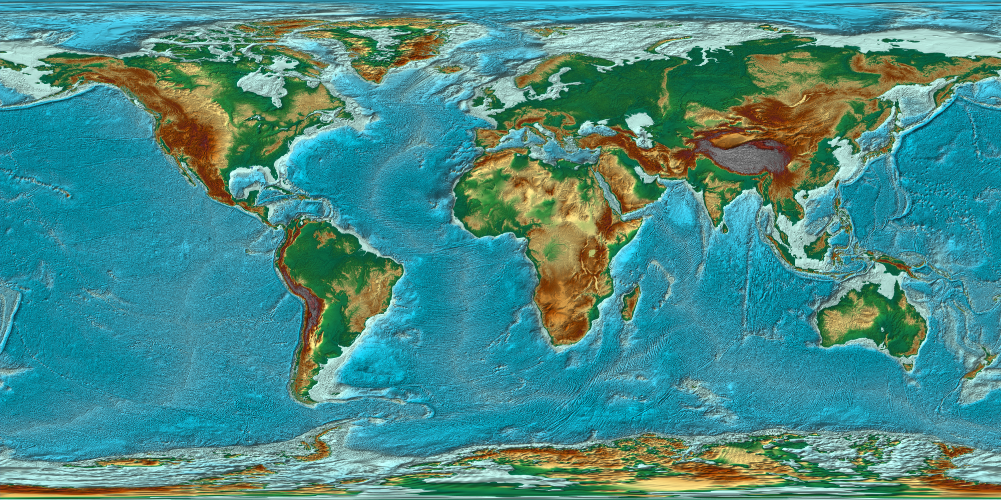
English: Generated using custom software (jDem846; not yet released) I have written in Java using algorithms derived from my earlier masters thesis software. The data is from NOAA ETOPO1 land elevation and ocean bathymetry at 1 arc minute.
The software is not yet feature complete as I plan to add support for ESRI shapefiles, additional raster input formats, and some limited three-dimensional rendering options. The full sized image (~120MB) is available upon request. |
| Date | |
| Source | https://www.flickr.com/photos/53460575@N03/5853039006/ |
| Author | Kevin M. Gill |
Licensing[edit]
This file is licensed under the Creative Commons Attribution 2.0 Generic license.
- You are free:
- to share – to copy, distribute and transmit the work
- to remix – to adapt the work
- Under the following conditions:
- attribution – You must give appropriate credit, provide a link to the license, and indicate if changes were made. You may do so in any reasonable manner, but not in any way that suggests the licensor endorses you or your use.
| This image was originally posted to Flickr by Kevin M. Gill at https://flickr.com/photos/53460575@N03/5853039006. It was reviewed on 24 October 2020 by FlickreviewR 2 and was confirmed to be licensed under the terms of the cc-by-2.0. |
File history
Click on a date/time to view the file as it appeared at that time.
| Date/Time | Thumbnail | Dimensions | User | Comment | |
|---|---|---|---|---|---|
| current | 05:45, 24 October 2020 | | 2,000 × 1,000 (4.5 MB) | Ser Amantio di Nicolao (talk | contribs) | Uploaded a work by Kevin M. Gill from https://www.flickr.com/photos/53460575@N03/5853039006/ with UploadWizard |
You cannot overwrite this file.
File usage on Commons
The following page uses this file: