File:WorldMap half of human live inside this circle.svg

From Wikimedia Commons, the free media repository
Jump to navigation Jump to search

Original file(SVG file, nominally 2,760 × 1,398 pixels, file size: 730 KB)
Captions

Captions

Add a one-line explanation of what this file represents

Summary[edit]

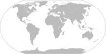
Description Blank world map. Circle represent half of world's population (inspired by youtube videos)
Date 2009-01, derivative 14:20, 14 November 2022 (UTC)
Source Own work based on: LocationWorld.png by David Kernow
Author
Original:
Vector:
, derivative Bennylin (yes?)
Other versions
Source: WorldMap.svg
SVG development
InfoField
 
The SVG code is valid.
 
This world map was created with Inkscape.

Licensing[edit]

Public domain
This image is in the public domain because it contains materials that originally came from the United States Central Intelligence Agency's World Factbook.

Bahasa Indonesia  čeština  Deutsch  eesti  English  español  Esperanto  français  galego  hrvatski  italiano  Nederlands  norsk nynorsk  polski  português  sicilianu  slovenščina  suomi  Türkçe  Zazaki  беларуская (тарашкевіца)  македонски  русский  српски / srpski  українська  ქართული  বাংলা  தமிழ்  മലയാളം  한국어  日本語  中文  中文(简体)  中文(繁體)  العربية  +/−

File history

Click on a date/time to view the file as it appeared at that time.

Date/TimeThumbnailDimensionsUserComment
current14:24, 14 November 2022Thumbnail for version as of 14:24, 14 November 20222,760 × 1,398 (730 KB)Bennylin (talk | contribs)
14:08, 14 November 2022Thumbnail for version as of 14:08, 14 November 20221,100 × 750 (316 KB)Bennylin (talk | contribs)== {{int:filedesc}} == {{Information |Description={{en|Blank world map (shore lines)}}{{fr|Carte vierge du monde (lignes des côtes)}} |Source={{en|{{F|Tectonic plates (empty).svg}} created by {{U|Ævar Arnfjörð Bjarmason}} under PD and based on an [http://pubs.usgs.gov/gip/dynamic/slabs.html USGS map]}} {{fr|{{F|Tectonic plates (empty).svg}} créée par {{U|Ævar Arnfjörð Bjarmason}} sous DP et basée sur une [http://pubs.usgs.gov/gip/dynamic/slabs.html carte de l'USGS]}} |Date=2006-10, derivative...

The following page uses this file:

Metadata