File:Whyalla-to-Cowell-aerial-view-1212.jpg
Jump to navigation
Jump to search

Size of this preview: 800 × 600 pixels. Other resolutions: 320 × 240 pixels | 640 × 480 pixels | 1,024 × 768 pixels | 1,280 × 960 pixels | 2,048 × 1,536 pixels.
Original file (2,048 × 1,536 pixels, file size: 1.6 MB, MIME type: image/jpeg)
Captions
Captions
Add a one-line explanation of what this file represents
| Description |
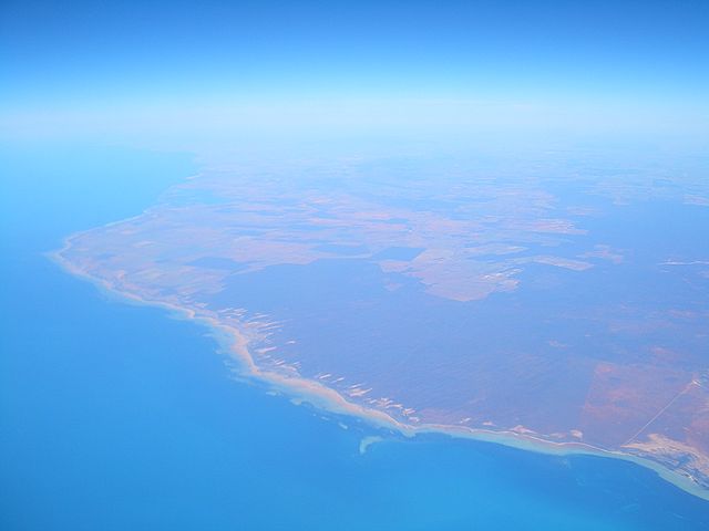
English: Aerial view of the north-eastern part of Eyre Peninsula and he adjacent part of Spencer Gulf. Looking from some point south of Whyalla toward the southwest. Comparing to Wikimapia (Google maps) imagery shows that the big lagoon in the upper left part of the photo is at Cowell, while a few shoals near the coast in the lower central part of the photo are about halfway between Whyalla and Cowell. |
| Date | |
| Source | Self-photographed |
| Author | User:Vmenkov |
| Permission (Reusing this file) |
Own work, copyleft: Multi-license with GFDL and Creative Commons CC-BY-SA-2.5 and older versions (2.0 and 1.0) |
I, the copyright holder of this work, hereby publish it under the following licenses:

|
Permission is granted to copy, distribute and/or modify this document under the terms of the GNU Free Documentation License, Version 1.2 or any later version published by the Free Software Foundation; with no Invariant Sections, no Front-Cover Texts, and no Back-Cover Texts. A copy of the license is included in the section entitled GNU Free Documentation License. |
| This file is licensed under the Creative Commons Attribution-Share Alike 3.0 Unported license. | ||
| ||
| This licensing tag was added to this file as part of the GFDL licensing update. |
This file is licensed under the Creative Commons Attribution-Share Alike 2.5 Generic, 2.0 Generic and 1.0 Generic license.
- You are free:
- to share – to copy, distribute and transmit the work
- to remix – to adapt the work
- Under the following conditions:
- attribution – You must give appropriate credit, provide a link to the license, and indicate if changes were made. You may do so in any reasonable manner, but not in any way that suggests the licensor endorses you or your use.
- share alike – If you remix, transform, or build upon the material, you must distribute your contributions under the same or compatible license as the original.
You may select the license of your choice.
File history
Click on a date/time to view the file as it appeared at that time.
| Date/Time | Thumbnail | Dimensions | User | Comment | |
|---|---|---|---|---|---|
| current | 05:26, 10 December 2008 | | 2,048 × 1,536 (1.6 MB) | Vmenkov (talk | contribs) | {{Information |Description={{en|Aerial view of the north-eastern part of Eyre Peninsula and he adjacent part of Gulf of St Vincent. Looking from some point south of Whyalla toward the southwest. Comparing to Wikimapia (Google maps) imagery shows that the |
You cannot overwrite this file.
File usage on Commons
The following page uses this file: