File:Wheeler Interchange map.svg
Jump to navigation
Jump to search

Size of this PNG preview of this SVG file: 800 × 569 pixels. Other resolutions: 320 × 228 pixels | 640 × 455 pixels | 1,024 × 729 pixels | 1,280 × 911 pixels | 2,560 × 1,821 pixels | 915 × 651 pixels.
Original file (SVG file, nominally 915 × 651 pixels, file size: 550 KB)
Captions
Captions
Add a one-line explanation of what this file represents
| Description |
|
||||||||||||
| Date | |||||||||||||
| Source | openstreetmap.org with File:I-5 (CA).svg and File:California 99.svg | ||||||||||||
| Author | OpenStreetMap contributors. Fredddie and SPUI | ||||||||||||
| Permission (Reusing this file) |
All OpenStreetMap data and maps are Creative Commons "CC-BY-SA 2.0"; marker graphics are in the public domain. This file is licensed under the Creative Commons Attribution-Share Alike 2.0 Generic license.
|
||||||||||||
.svg)
File history
Click on a date/time to view the file as it appeared at that time.
| Date/Time | Thumbnail | Dimensions | User | Comment | |
|---|---|---|---|---|---|
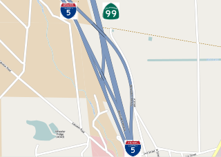
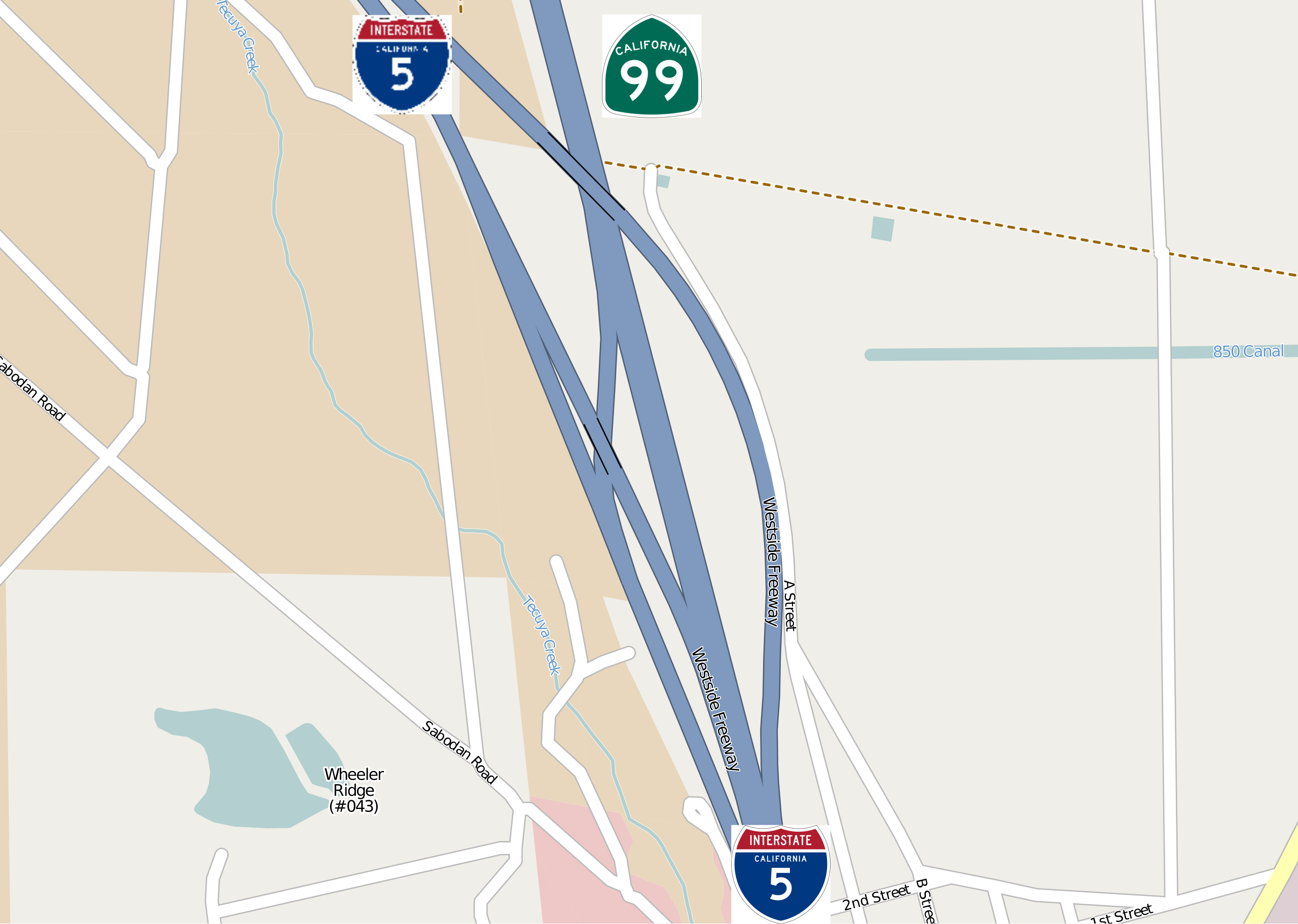
| current | 23:43, 7 March 2012 | | 915 × 651 (550 KB) | Imzadi1979 (talk | contribs) | {{OpenStreetMap |description={{en|Map of the Wheeler Interchange in Kern County, California}} |top=35.02162 |bottom=35.00658 |left=-118.96721 |right=-118.94142 |date= {{date|2012|01|31}} }} [[Cate... |
You cannot overwrite this file.
File usage on Commons
There are no pages that use this file.
File usage on other wikis
The following other wikis use this file:
- Usage on www.wikidata.org