File:Westmere, 1946.jpg
Jump to navigation
Jump to search
Size of this preview: 721 × 600 pixels. Other resolutions: 289 × 240 pixels | 577 × 480 pixels | 923 × 768 pixels | 1,231 × 1,024 pixels | 1,999 × 1,663 pixels.
Original file (1,999 × 1,663 pixels, file size: 325 KB, MIME type: image/jpeg)
Captions
Captions
Add a one-line explanation of what this file represents
Summary[edit]
| Description |
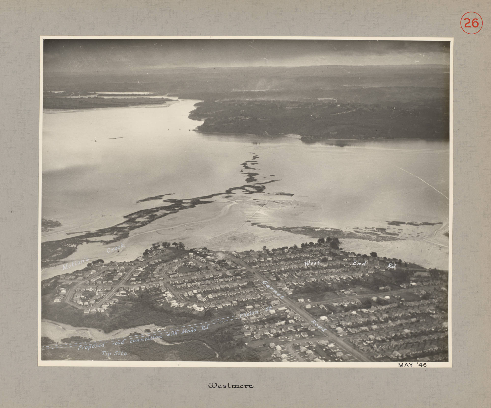
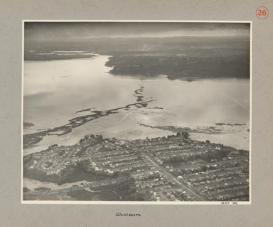
English: Westmere, 1946. Westmere - Map 26: Tip site, Proposed road connection with Meola Road, Phelan Street, Garnet Road, West End Road, Motion's Creek. Showing the Waitemata Harbour and the Meola Reef.
Whites Aviation number WA-02389-G. Auckland Libraries Heritage Collections 580-ALB22-026 |
| Date | |
| Source | https://kura.aucklandlibraries.govt.nz/digital/collection/photos/id/117972/ |
| Author | Whites Aviation |
| Other versions |
.jpg)
Licensing[edit]
This file is licensed under the Creative Commons Attribution 4.0 International license.
- You are free:
- to share – to copy, distribute and transmit the work
- to remix – to adapt the work
- Under the following conditions:
- attribution – You must give appropriate credit, provide a link to the license, and indicate if changes were made. You may do so in any reasonable manner, but not in any way that suggests the licensor endorses you or your use.
File history
Click on a date/time to view the file as it appeared at that time.
| Date/Time | Thumbnail | Dimensions | User | Comment | |
|---|---|---|---|---|---|
| current | 01:15, 22 July 2022 | | 1,999 × 1,663 (325 KB) | Prosperosity (talk | contribs) | Uploaded a work by Whites Aviation from https://kura.aucklandlibraries.govt.nz/digital/collection/photos/id/117972/ with UploadWizard |
You cannot overwrite this file.
File usage on Commons
The following 2 pages use this file:
.jpg)