File:Western Canada map.png
Jump to navigation
Jump to search
No higher resolution available.
Western_Canada_map.png (262 × 212 pixels, file size: 3 KB, MIME type: image/png)
Captions
Captions
Add a one-line explanation of what this file represents

|
This locator map image could be re-created using vector graphics as an SVG file. This has several advantages; see Commons:Media for cleanup for more information. If an SVG form of this image is available, please upload it and afterwards replace this template with
{{vector version available|new image name}}.
It is recommended to name the SVG file “Western Canada map.svg”—then the template Vector version available (or Vva) does not need the new image name parameter. |
Other versions:

Summary[edit]
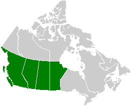
Map: Western Canada (political); based on Image:Canada provinces blank vide.png
Licensing[edit]
| I, the copyright holder of this work, release this work into the public domain. This applies worldwide. In some countries this may not be legally possible; if so: I grant anyone the right to use this work for any purpose, without any conditions, unless such conditions are required by law. |
File history
Click on a date/time to view the file as it appeared at that time.
| Date/Time | Thumbnail | Dimensions | User | Comment | |
|---|---|---|---|---|---|
| current | 09:40, 12 February 2006 | | 262 × 212 (3 KB) | E Pluribus Anthony~commonswiki (talk | contribs) | Map: Western Canada (political) |
You cannot overwrite this file.
File usage on Commons
The following page uses this file:
File usage on other wikis
The following other wikis use this file:
- Usage on cs.wikipedia.org
- Usage on de.wikipedia.org
- Usage on en.wikipedia.org
- User:Trfs
- User:Klingoncowboy4
- User:T. Sutherland
- User:Wikilo12
- Wikipedia:Userboxes/Location/Canada
- User:Ndpjohnny
- Helen Belyea
- User:Tblore
- Western alienation
- User:CanuckGod
- Template:User Western Canada
- User:Fatck
- User:Cheifsguy
- User:TotallyTempo
- User:OddAud
- User:StarTrekker1337
- User:Viper1265
- User:Addict 2006
- User:Zoriac255
- User:Comrade Graham
- User:Sndbox
- User:Vancouver robin
- User:JimboV1
- User:Knowledgeum
- User:Thew ent dan
- User:Knerlo
- User:OlEnglish
- User:Corath
- User:Colilace5
- User:ScreenGuru
- User:Jwkozak91
- User:Sneef1234
- User:Gerdel/UserBoxes(About Me)
- User:LancethePenguin
- User:Mtylerb
- User:Wdevauld
- User talk:24.89.95.149/userboxes
- User:JamesBay/sandbox
- User:Jtayl132
- User:MusicalGenius711
- Template:User from Western Canda
- Usage on fr.wikipedia.org
- Usage on ha.wikipedia.org
- Usage on mk.wikipedia.org
- Usage on ml.wikipedia.org
- Usage on nl.wikipedia.org
- Usage on sk.wikipedia.org
View more global usage of this file.