File:Welcome to Northumberland County, Virginia State Route 200, Near Kilmarnock, Virginia (14299534308).jpg

Original file (4,000 × 3,000 pixels, file size: 4.4 MB, MIME type: image/jpeg)
Captions
Captions
Summary[edit]
.jpg&action=edit§ion=1)
| Description |
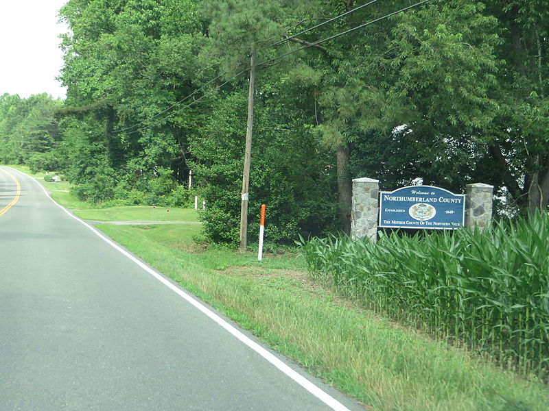
Northumberland County is a county located in the Commonwealth of Virginia. As of the 2010 census, the population was 12,330. Its county seat is Heathsville. The county is located on the Northern Neck peninsula and is part of the Northern Neck George Washington Birthplace AVA winemaking appellation. The area was occupied at the time of English settlement by the Algonquian-speaking historic tribes of the Wicocomico and Chickacoan. The county was created by the Virginia General Assembly in 1648 during a period of rapid population growth and geographic expansion. Settlement began in this area of the Northern Neck around 1635. Originally known as the Indian district Chickacoan, the area was first referred to as Northumberland in the colonial records in 1644. The following year, John Mottrom served as the first burgess for the territory in the House of Burgesses, which met at the capital of the Virginia Colony at Jamestown. The colonial court ordered the two tribes to merge and by 1655, assigned them a reservation of 4,400 acres (18 km2) near Dividing Creek, and south of the Great Wicomico River. By the early 1700s, the tribe was reduced and the English took their lands. They were believed extinct as a tribe as, landless, they disappeared from the historical record. Descendants of the last weroance are working to regain recognition as a tribe, the Wicocomico Indian Nation. The size of the county was drastically reduced in 1651 and 1653 as the colonial government organized Lancaster and Westmoreland counties from it. Of the 172 counties that have ever existed in Virginia's history, Northumberland ended up being an "ancestor" of 116 of these –– more than the current 95 counties (several were lost to other states, such as West Virginia). en.wikipedia.org/wiki/Northumberland_County,_Virginia en.wikipedia.org/wiki/Wikipedia:Text_of_Creative_Commons_... |
| Date | |
| Source | Welcome to Northumberland County, Virginia State Route 200, Near Kilmarnock, Virginia |
| Author | Ken Lund from Reno, Nevada, USA |
| Camera location | | View this and other nearby images on: OpenStreetMap |
|---|
.jpg¶ms=037.727394_N_-076.365873_E_globe:Earth_type:camera_source:Flickr_&language=en)
Licensing[edit]
.jpg&action=edit§ion=2)
- You are free:
- to share – to copy, distribute and transmit the work
- to remix – to adapt the work
- Under the following conditions:
- attribution – You must give appropriate credit, provide a link to the license, and indicate if changes were made. You may do so in any reasonable manner, but not in any way that suggests the licensor endorses you or your use.
- share alike – If you remix, transform, or build upon the material, you must distribute your contributions under the same or compatible license as the original.
| This image was originally posted to Flickr by Ken Lund at https://flickr.com/photos/75683070@N00/14299534308. It was reviewed on 12 April 2016 by FlickreviewR and was confirmed to be licensed under the terms of the cc-by-sa-2.0. |
File history
Click on a date/time to view the file as it appeared at that time.
| Date/Time | Thumbnail | Dimensions | User | Comment | |
|---|---|---|---|---|---|
| current | 05:48, 12 April 2016 | | 4,000 × 3,000 (4.4 MB) | Ser Amantio di Nicolao (talk | contribs) | Transferred from Flickr via Flickr2Commons |
You cannot overwrite this file.
File usage on Commons
There are no pages that use this file.
.jpg&oldid=575746010)