File:Walnys Plan von Sarajevo und Umgebung.jpg
Jump to navigation
Jump to search

Size of this preview: 800 × 583 pixels. Other resolutions: 320 × 233 pixels | 640 × 466 pixels | 1,024 × 746 pixels | 1,280 × 933 pixels | 2,560 × 1,865 pixels | 12,234 × 8,914 pixels.
Original file (12,234 × 8,914 pixels, file size: 17.89 MB, MIME type: image/jpeg)
Captions
Captions
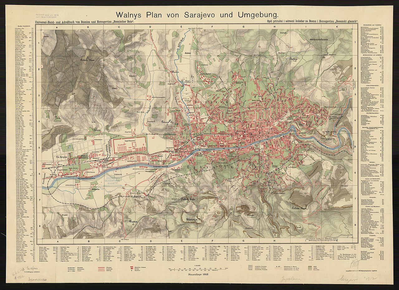
1912 map of Sarajevo
Summary[edit]
| Warning | The original file is very high-resolution. It might not load properly or could cause your browser to freeze when opened at full size. |
|---|
| Description |
English: 1912 map of Sarajevo. Shows roads, churches, mosques, cemeteries (Christian, Turkish and Jewish), woods, gardens, pastures and public buildings.; Relief shown by shading, contours and spot heights.; Includes indexes in margins.; Universal-Hand- und Adressbuch von Bosnien und Hercegovina "Bosnischer Bote" -- top left margin.; Opći priručni i adresni koledar za Bosnu i Hercegovinu "Bosanski glasnik" -- top right margin. 1 map : color ; 60 x 83 cm |
| Date | |
| Source | American Geographical Society Library, University of Wisconsin-Milwaukee Libraries |
| Author |

Licensing[edit]
|
This work is in the public domain in its country of origin and other countries and areas where the copyright term is the author's life plus 70 years or fewer. This work is in the public domain in the United States because it was published (or registered with the U.S. Copyright Office) before January 1, 1929. | |
| This file has been identified as being free of known restrictions under copyright law, including all related and neighboring rights. | |
File history
Click on a date/time to view the file as it appeared at that time.
| Date/Time | Thumbnail | Dimensions | User | Comment | |
|---|---|---|---|---|---|
| current | 20:32, 23 February 2019 | | 12,234 × 8,914 (17.89 MB) | Balkanique (talk | contribs) | User created page with UploadWizard |
You cannot overwrite this file.
File usage on Commons
The following 2 pages use this file: