File:Waldseemuller map Caribbean.jpg
Jump to navigation
Jump to search
Size of this preview: 405 × 600 pixels. Other resolutions: 162 × 240 pixels | 324 × 480 pixels | 519 × 768 pixels | 692 × 1,024 pixels | 2,057 × 3,045 pixels.
Original file (2,057 × 3,045 pixels, file size: 3.89 MB, MIME type: image/jpeg)
Captions
Captions
Add a one-line explanation of what this file represents
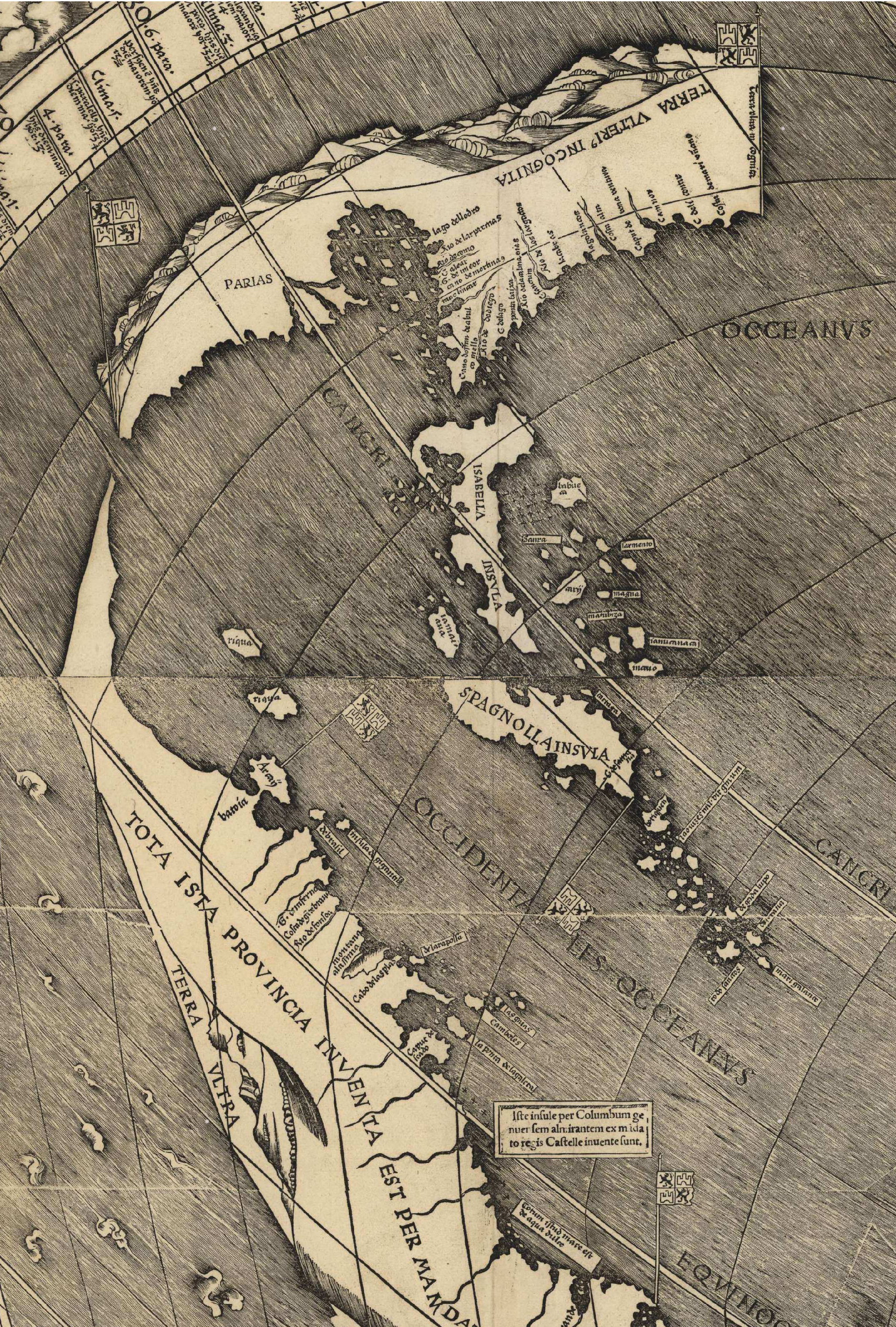
| Description | Fragment of the Waldseemüller map centered around the Caribbean region. | |||||||||||||||||||||||
| Date | (UTC) | |||||||||||||||||||||||
| Source | ||||||||||||||||||||||||
| Author |
|
|||||||||||||||||||||||

| This is a retouched picture, which means that it has been digitally altered from its original version. Modifications: Cropped to Caribbean and merged tiles. The original can be viewed here: Waldseemuller map 2.jpg:
|
|
This is a faithful photographic reproduction of a two-dimensional, public domain work of art. The work of art itself is in the public domain for the following reason:
The official position taken by the Wikimedia Foundation is that "faithful reproductions of two-dimensional public domain works of art are public domain".
This photographic reproduction is therefore also considered to be in the public domain in the United States. In other jurisdictions, re-use of this content may be restricted; see Reuse of PD-Art photographs for details. | ||||
Original upload log[edit]
This image is a derivative work of the following images:
- File:Waldseemuller_map_2.jpg licensed with PD-old
- 2008-10-27T17:37:08Z Jackaranga 13708x7590 (20608962 Bytes) {{Information |Description={{en|1=waldseemuller map, full page from http://memory.loc.gov/cgi-bin/map_item.pl?data=/home/www/data/gmd/gmd3/g3200/g3200/ct000725.jp2&style=gmd&itemLink=r?ammem/gmd:@field(NUMBER+@band(g3200+ct00
Uploaded with derivativeFX
File history
Click on a date/time to view the file as it appeared at that time.
| Date/Time | Thumbnail | Dimensions | User | Comment | |
|---|---|---|---|---|---|
| current | 03:27, 1 April 2009 | | 2,057 × 3,045 (3.89 MB) | Monfornot (talk | contribs) | {{Information |Description=Fragment of the Waldseemüller map centered around the Caribbean region. |Source=*File:Waldseemuller_map_2.jpg |Date=2009-04-01 04:25 (UTC) |Author=*File:Waldseemuller_map_2.jpg: Waldseemul |
You cannot overwrite this file.
File usage on Commons
There are no pages that use this file.
File usage on other wikis
The following other wikis use this file:
- Usage on be.wikipedia.org
- Usage on bg.wikipedia.org
- Usage on hy.wikipedia.org
- Usage on hyw.wikipedia.org
- Usage on ru.wikipedia.org