File:Würzburg — Rathauskomplex — Luftbild mit überlagerter Parzellarkarte.jpg
Jump to navigation
Jump to search

Size of this preview: 601 × 599 pixels. Other resolutions: 241 × 240 pixels | 482 × 480 pixels | 771 × 768 pixels | 1,027 × 1,024 pixels | 2,428 × 2,420 pixels.
Original file (2,428 × 2,420 pixels, file size: 560 KB, MIME type: image/jpeg)
Captions
Captions
Add a one-line explanation of what this file represents
Summary[edit]
| Description |
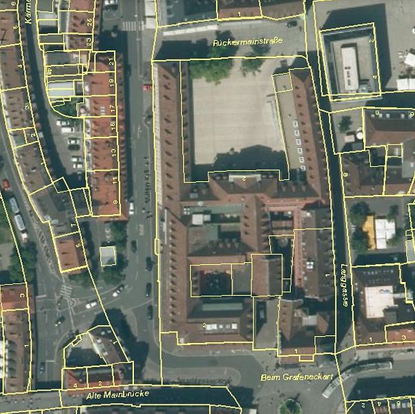
Deutsch: Luftbild (digitales Orthophoto) mit überlagerter Parzellarkarte |
| Date | circa 2016 |
| Source | https://geoportal.bayern.de/bayernatlas/?X=5519535.39&Y=4350932.37&zoom=14&lang=de&topic=ba&bgLayer=luftbild_parz&geolocation=true&catalogNodes=122 |
| Author | Datenquelle: Bayerische Vermessungsverwaltung http://vermessung.bayern.de/opendata |
This is a picture of the Bavarian Baudenkmal (cultural heritage monument) with the ID D-6-63-000-37 (Wikidata)
|
Licensing[edit]
This file is licensed under the Creative Commons Attribution 3.0 Germany license.
- You are free:
- to share – to copy, distribute and transmit the work
- to remix – to adapt the work
- Under the following conditions:
- attribution – You must give appropriate credit, provide a link to the license, and indicate if changes were made. You may do so in any reasonable manner, but not in any way that suggests the licensor endorses you or your use.

File history
Click on a date/time to view the file as it appeared at that time.
| Date/Time | Thumbnail | Dimensions | User | Comment | |
|---|---|---|---|---|---|
| current | 07:58, 5 October 2016 | | 2,428 × 2,420 (560 KB) | Mattes (talk | contribs) | == {{int:filedesc}} == {{Information |Description={{DEU}} > {{Würzburg}} > Rathauskomplex (mittig)) {{de|Luftbild (digitales Orthophoto) mit überlagerter Parzellarkarte}} |Source = https://geoportal.bayern.de/bayernatlas/?X=5519535.39&Y=43509... |
You cannot overwrite this file.
File usage on Commons
The following 4 pages use this file:
File usage on other wikis
The following other wikis use this file:
- Usage on de.wikipedia.org