File:Vnější Západní Karpaty-hu.svg
Jump to navigation
Jump to search

Size of this PNG preview of this SVG file: 800 × 533 pixels. Other resolutions: 320 × 213 pixels | 640 × 427 pixels | 1,024 × 683 pixels | 1,280 × 853 pixels | 2,560 × 1,707 pixels | 999 × 666 pixels.
Original file (SVG file, nominally 999 × 666 pixels, file size: 101 KB)
Captions
Captions
Add a one-line explanation of what this file represents
| Description |
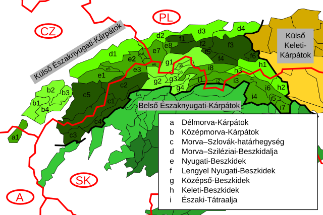
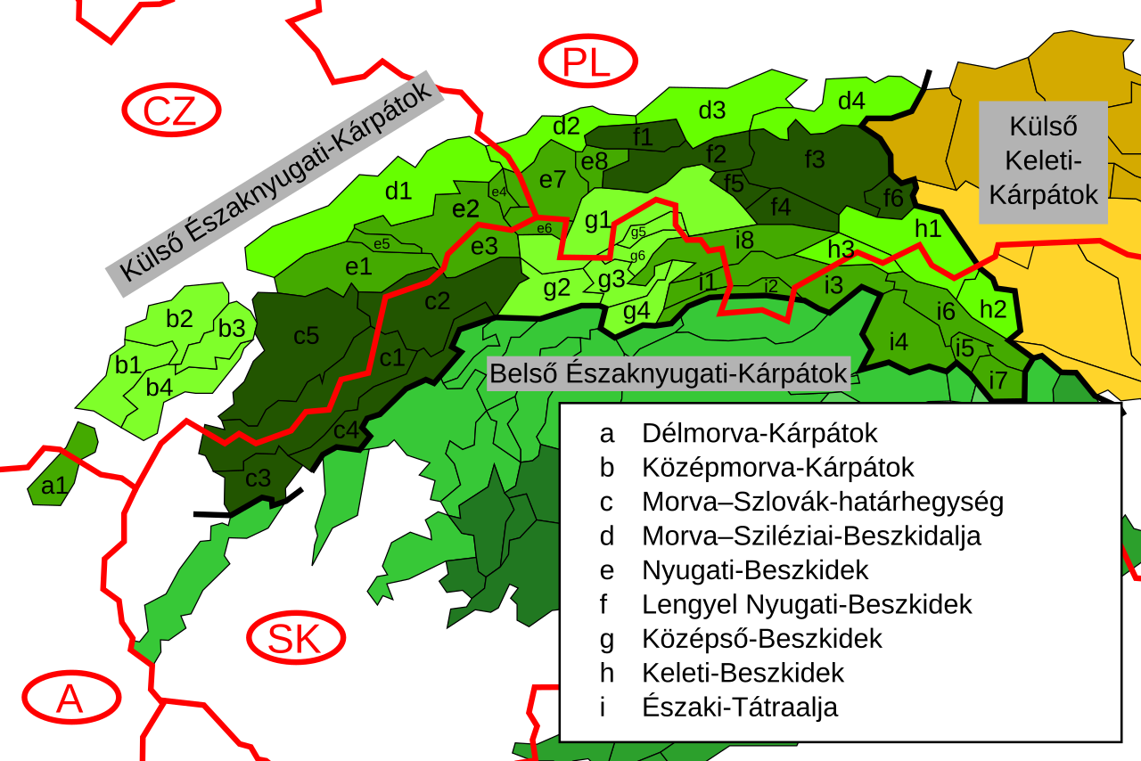
English: Map of the Outer Western Carpathians with labels in Hungarian. |
| Date | (UTC) |
| Source | |
| Author |
|
| Other versions |
|

| This is a retouched picture, which means that it has been digitally altered from its original version. Modifications: Translation to Hungarian language. The original can be viewed here: Vnější Západní Karpaty.svg:
|
I, the copyright holder of this work, hereby publish it under the following license:
This file is licensed under the Creative Commons Attribution-Share Alike 3.0 Unported license.
- You are free:
- to share – to copy, distribute and transmit the work
- to remix – to adapt the work
- Under the following conditions:
- attribution – You must give appropriate credit, provide a link to the license, and indicate if changes were made. You may do so in any reasonable manner, but not in any way that suggests the licensor endorses you or your use.
- share alike – If you remix, transform, or build upon the material, you must distribute your contributions under the same or compatible license as the original.
Original upload log
[edit]
This image is a derivative work of the following images:
- File:Vnější_Západní_Karpaty.svg licensed with Cc-by-sa-3.0
- 2008-03-16T15:19:10Z Daniel Baránek 999x666 (100899 Bytes) {{Information |Description={{cs|[[:cs:Vnější Západní Karpaty]]}} |Source=Created from [[:Image:Divisions of the Carpathians.png]] |Date=2008-03-16 |Author=~~~ |Permission= |other_versions= }}
Uploaded with derivativeFX
File history
Click on a date/time to view the file as it appeared at that time.
| Date/Time | Thumbnail | Dimensions | User | Comment | |
|---|---|---|---|---|---|
| current | 20:41, 27 June 2011 | | 999 × 666 (101 KB) | Piroska (talk | contribs) | Removing a wrong label. |
| 21:28, 6 November 2009 |  | 999 × 666 (101 KB) | Piroska (talk | contribs) | {{Information |Description={{en|Map of the Outer Western Carpathians with labels in Hungarian.}} |Source=*File:Vnější_Západní_Karpaty.svg |Date=2009-11-06 21:26 (UTC) |Author=*[[:File:Vnější_Západní_Karpaty.svg| |
You cannot overwrite this file.
File usage on Commons
The following page uses this file:
File usage on other wikis
The following other wikis use this file:
- Usage on hu.wikipedia.org