File:Vicksburg harbor aerial view.jpg
Jump to navigation
Jump to search

Size of this preview: 800 × 533 pixels. Other resolutions: 320 × 213 pixels | 640 × 427 pixels | 1,024 × 683 pixels | 1,500 × 1,000 pixels.
Original file (1,500 × 1,000 pixels, file size: 515 KB, MIME type: image/jpeg)
Captions
Captions
Add a one-line explanation of what this file represents
| Description |
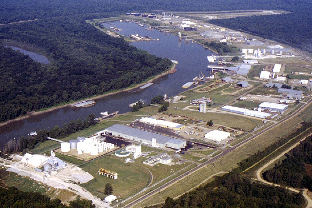
English: Aerial view of the Vicksburg Harbor, which is located on an arm of the Mississippi River at Vicksburg, Mississippi, USA. The harbor is located north of the main part of the city. View is to the west-northwest. |
|||
| Date | ||||
| Source |
U.S. Army Corps of Engineers Digital Visual Library Image page Image description page Digital Visual Library home page |
|||
| Author | Brad Emerson, U.S. Army Corps of Engineers | |||
| Permission (Reusing this file) |
|
|||
| Location | Vicksburg, Mississippi, USA |
| Camera location | | View this and other nearby images on: OpenStreetMap |
|---|
File history
Click on a date/time to view the file as it appeared at that time.
| Date/Time | Thumbnail | Dimensions | User | Comment | |
|---|---|---|---|---|---|
| current | 00:52, 6 April 2007 | | 1,500 × 1,000 (515 KB) | DanMS (talk | contribs) | {{Information | Description = {{en|Aerial view of the Vicksburg Harbor, which is located on an arm of the Mississippi River at Vicksburg, Mississippi, USA. The harbor is located north of the main part of the city. View is to the west-northwest.}} | |
You cannot overwrite this file.
File usage on Commons
There are no pages that use this file.
File usage on other wikis
The following other wikis use this file:
- Usage on fa.wikipedia.org
- Usage on ja.wikipedia.org
- Usage on la.wikipedia.org
- Usage on ru.wikipedia.org
- Usage on sh.wikipedia.org
- Usage on sr.wikipedia.org
- Usage on uz.wikipedia.org
- Usage on vi.wikipedia.org
- Usage on zh.wikipedia.org