File:Verzweigung Reichenburg, A3(W) A15(N) A3(E) - detail map by OpenStreetMap contributors, 2022.png
Jump to navigation
Jump to search

Size of this preview: 606 × 600 pixels. Other resolutions: 243 × 240 pixels | 485 × 480 pixels | 856 × 847 pixels.
Original file (856 × 847 pixels, file size: 230 KB, MIME type: image/png)
Captions
Captions
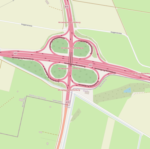
map of Verzweigung Reichenburg, motorway interchange in Switzerland
Summary[edit]
_A15(N)_A3(E)_-_detail_map_by_OpenStreetMap_contributors,_2022.png&action=edit§ion=1)
| Description | |
| Date | |
| Source | OpenStreetMap |
| Author | OpenStreetMap contributors |
| Object location | | View this and other nearby images on: OpenStreetMap |
|---|
_A15(N)_A3(E)_-_detail_map_by_OpenStreetMap_contributors,_2022.png¶ms=047.183900_N_0008.977000_E_globe:Earth_class:object_type:object__&language=en)
Licensing[edit]
_A15(N)_A3(E)_-_detail_map_by_OpenStreetMap_contributors,_2022.png&action=edit§ion=2)
| This work contains information from OpenStreetMap, which is made available under the Open Database License (ODbL).
The ODbL does not require any particular license for maps produced from ODbL data. Prior to 1 August 2020, map tiles produced by the OpenStreetMap Foundation were licensed under the CC-BY-SA-2.0 license. Maps produced by other people may be subject to other licences. |
File history
Click on a date/time to view the file as it appeared at that time.
| Date/Time | Thumbnail | Dimensions | User | Comment | |
|---|---|---|---|---|---|
| current | 08:33, 21 March 2022 | | 856 × 847 (230 KB) | Enhancing999 (talk | contribs) | resolution |
| 19:17, 20 March 2022 |  | 287 × 213 (40 KB) | Enhancing999 (talk | contribs) | Uploaded a work by [https://www.openstreetmap.org/ OpenStreetMap contributors] from [https://www.openstreetmap.org/ OpenStreetMap] with UploadWizard |
You cannot overwrite this file.
File usage on Commons
The following 2 pages use this file:
File usage on other wikis
The following other wikis use this file:
- Usage on de.wikipedia.org
_A15(N)_A3(E)_-_detail_map_by_OpenStreetMap_contributors,_2022.png&oldid=661500623)