File:VermilionCliffsMap.jpg
Jump to navigation
Jump to search
Size of this preview: 455 × 599 pixels. Other resolutions: 182 × 240 pixels | 500 × 658 pixels.
Original file (500 × 658 pixels, file size: 62 KB, MIME type: image/jpeg)
Captions
Captions
Add a one-line explanation of what this file represents
| Description |
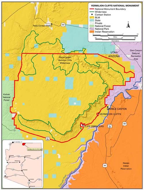
English: Map of Vermilion Cliffs National Monument — in Coconino County, northern Arizona.
|
|||
| Source | http://www.blm.gov/az/vermilion/vermilmap.html | |||
| Author | BLM Map | |||
| Permission (Reusing this file) |
|
File history
Click on a date/time to view the file as it appeared at that time.
| Date/Time | Thumbnail | Dimensions | User | Comment | |
|---|---|---|---|---|---|
| current | 20:34, 28 February 2007 | | 500 × 658 (62 KB) | H-stt (talk | contribs) | {{Information |Description= Map of Vermilion cliffs National Monument, Arizona |Source= http://www.blm.gov/az/vermilion/vermilmap.html |Date= |Author= BLM Map |Permission= {{PD-USGov-BLM}} |other_versions= }} [[Category: Vermilion Cliffs National Monumen |
You cannot overwrite this file.
File usage on Commons
The following page uses this file:
File usage on other wikis
The following other wikis use this file:
- Usage on de.wikipedia.org
- Usage on hu.wikipedia.org