File:Vauxhall Bridge (2) - geograph.org.uk - 831240.jpg
Jump to navigation
Jump to search
No higher resolution available.
Vauxhall_Bridge_(2)_-_geograph.org.uk_-_831240.jpg (640 × 480 pixels, file size: 57 KB, MIME type: image/jpeg)
Captions
Captions
Add a one-line explanation of what this file represents
Summary[edit]
_-_geograph.org.uk_-_831240.jpg&action=edit§ion=1)
| Description |
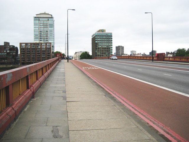
English: Vauxhall Bridge (2) The bridge is 80 feet or about 24 metres wide, and carries the A202 road over the River Thames. It is also currently the southern entrance to the Free Route through the Congestion Charging zone on the northern side of the river. The two tall buildings in the distance are Rivermill House to the left and Riverwalk House to the right, the latter being the home of the Government Office For London. There are Red Route Urban Clearway road markings in the dedicated bus lane. |
| Date | |
| Source | From geograph.org.uk |
| Author | Nigel Cox |
| Attribution (required by the license) | Nigel Cox / Vauxhall Bridge (2) / |
| Camera location | | View this and other nearby images on: OpenStreetMap |
|---|
_-_geograph.org.uk_-_831240.jpg¶ms=051.487300_N_-000.125000_E_globe:Earth_type:camera_source:geograph-osgb36(TQ302781)_heading:315.00&language=en)
| Object location | | View this and other nearby images on: OpenStreetMap |
|---|
_-_geograph.org.uk_-_831240.jpg¶ms=051.488200_N_-000.127000_E_globe:Earth_class:object_type:object_source:geograph-osgb36(TQ301782)_heading:315.00&language=en)
Licensing[edit]
_-_geograph.org.uk_-_831240.jpg&action=edit§ion=2)

|
This image was taken from the Geograph project collection. See this photograph's page on the Geograph website for the photographer's contact details. The copyright on this image is owned by Nigel Cox and is licensed for reuse under the Creative Commons Attribution-ShareAlike 2.0 license.
|
This file is licensed under the Creative Commons Attribution-Share Alike 2.0 Generic license.
Attribution: Nigel Cox
- You are free:
- to share – to copy, distribute and transmit the work
- to remix – to adapt the work
- Under the following conditions:
- attribution – You must give appropriate credit, provide a link to the license, and indicate if changes were made. You may do so in any reasonable manner, but not in any way that suggests the licensor endorses you or your use.
- share alike – If you remix, transform, or build upon the material, you must distribute your contributions under the same or compatible license as the original.
File history
Click on a date/time to view the file as it appeared at that time.
| Date/Time | Thumbnail | Dimensions | User | Comment | |
|---|---|---|---|---|---|
| current | 21:04, 20 February 2011 | | 640 × 480 (57 KB) | GeographBot (talk | contribs) | == {{int:filedesc}} == {{Information |description={{en|1=Vauxhall Bridge (2) The bridge is 80 feet or about 24 metres wide, and carries the A202 road over the River Thames. It is also currently the southern entrance to the Free Route through the Congestio |
You cannot overwrite this file.
File usage on Commons
There are no pages that use this file.
_-_geograph.org.uk_-_831240.jpg&oldid=818748397)