File:Uwharrie Wood Run Trail Map.jpg
Jump to navigation
Jump to search
Size of this preview: 364 × 600 pixels. Other resolutions: 146 × 240 pixels | 291 × 480 pixels | 466 × 768 pixels | 1,054 × 1,736 pixels.
Original file (1,054 × 1,736 pixels, file size: 734 KB, MIME type: image/jpeg)
Captions
Captions
Add a one-line explanation of what this file represents
Summary
[edit]
| Description |
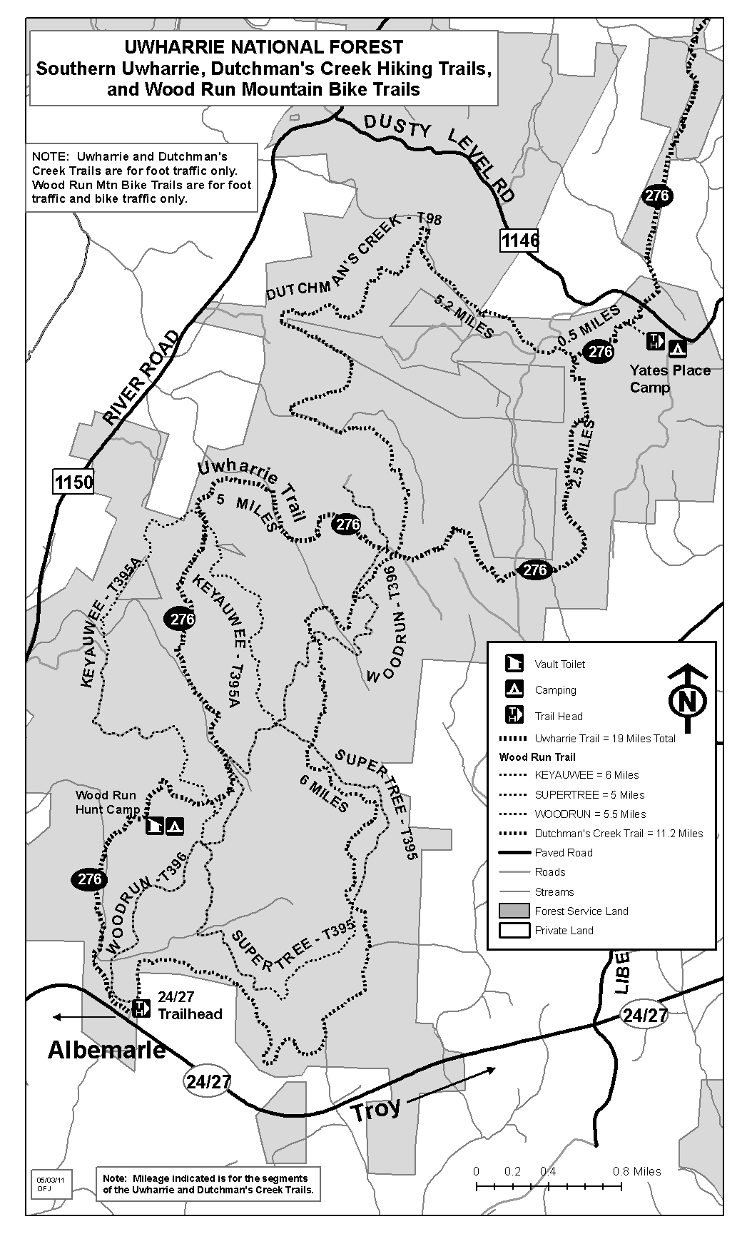
English: Trail map of the Wood Run area of the Uwharrie National Forest, North Carolina. The map depicts the southern-most portion of the Uwharrie National Recreation Trail, the Dutchman's Creek Trail, and the Wood Run Mountain Bike Trails. |
| Date | |
| Source | http://www.fs.usda.gov/Internet/FSE_MEDIA/stelprdb5298852.jpg |
| Author | United States Forest Service |
Licensing
[edit]
This image is a work of the Forest Service of the United States Department of Agriculture. As a work of the U.S. federal government, the image is in the public domain.
|
File history
Click on a date/time to view the file as it appeared at that time.
| Date/Time | Thumbnail | Dimensions | User | Comment | |
|---|---|---|---|---|---|
| current | 09:43, 2 September 2015 | | 1,054 × 1,736 (734 KB) | Sparkgap (talk | contribs) | User created page with UploadWizard |
You cannot overwrite this file.
File usage on Commons
The following page uses this file: