File:Utsjocki Charta öfwer twisten mellan Swerige och Norje 1747 1748.svg
Jump to navigation
Jump to search

Size of this PNG preview of this SVG file: 800 × 407 pixels. Other resolutions: 320 × 163 pixels | 640 × 326 pixels | 1,024 × 521 pixels | 1,280 × 651 pixels | 2,560 × 1,303 pixels | 4,143 × 2,108 pixels.
Original file (SVG file, nominally 4,143 × 2,108 pixels, file size: 294 KB)
Captions
Captions
Add a one-line explanation of what this file represents
Summary[edit]
| Description |
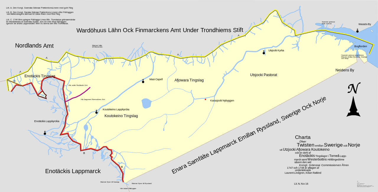
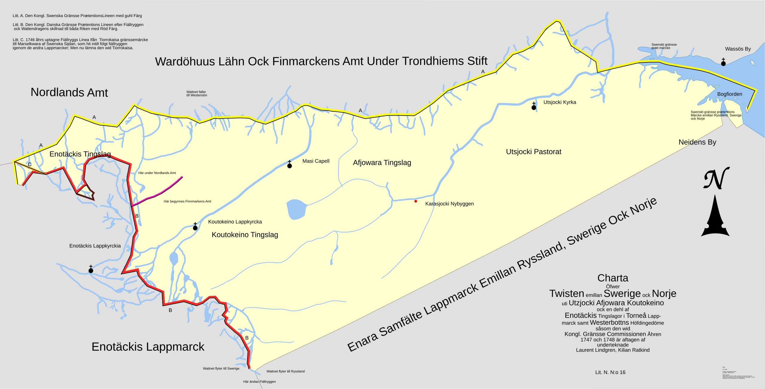
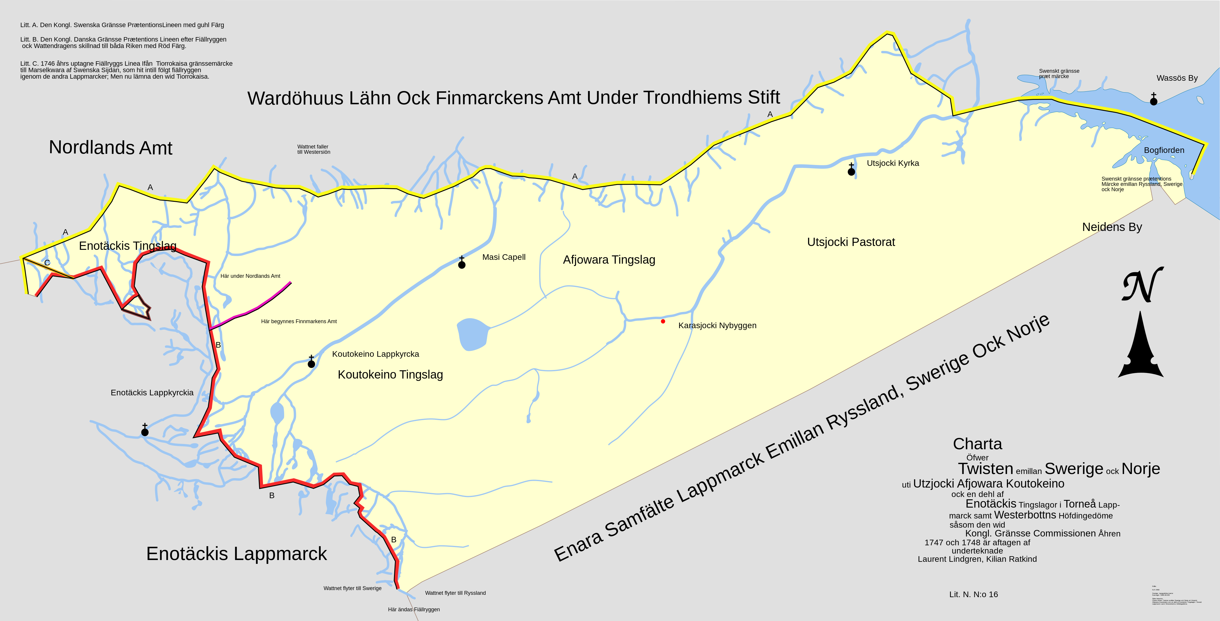
English: Map of Swedish claims to Utsjocki, Karasjocki and Koutokeino on the border between Sweden/Norway/Finland/Russia. Based on infromation from map made 1747 and 1748 by a Swedish government commission. Not all information from the original map is included. The map has been rotated so that north is up. Source: map in the collection of the Swedish War-Archives, made available by Riksarkivet via SVAR.[1] |
| Date | |
| Source | Own work |
| Author | Edaen |
Licensing[edit]
I, the copyright holder of this work, hereby publish it under the following license:
This file is licensed under the Creative Commons Attribution 3.0 Unported license.
- You are free:
- to share – to copy, distribute and transmit the work
- to remix – to adapt the work
- Under the following conditions:
- attribution – You must give appropriate credit, provide a link to the license, and indicate if changes were made. You may do so in any reasonable manner, but not in any way that suggests the licensor endorses you or your use.
File history
Click on a date/time to view the file as it appeared at that time.
| Date/Time | Thumbnail | Dimensions | User | Comment | |
|---|---|---|---|---|---|
| current | 17:43, 14 July 2011 | | 4,143 × 2,108 (294 KB) | Edaen (talk | contribs) | Some minor fixes |
| 11:10, 14 July 2011 |  | 4,139 × 2,109 (294 KB) | Edaen (talk | contribs) |
You cannot overwrite this file.
File usage on Commons
There are no pages that use this file.
File usage on other wikis
The following other wikis use this file:
- Usage on nn.wikipedia.org
- Usage on sv.wikipedia.org