File:Unknown water-related feature (ceb4fae5-f400-4ead-ae55-60076cf1c266).JPG
Jump to navigation
Jump to search

Size of this preview: 800 × 600 pixels. Other resolutions: 320 × 240 pixels | 640 × 480 pixels | 1,024 × 768 pixels | 1,280 × 960 pixels | 2,560 × 1,920 pixels | 3,264 × 2,448 pixels.
Original file (3,264 × 2,448 pixels, file size: 2.94 MB, MIME type: image/jpeg)
Captions
Captions
Add a one-line explanation of what this file represents
| Camera location | | View this and other nearby images on: OpenStreetMap |
|---|
.JPG¶ms=031.568475_N_-111.050683_E_globe:Earth_type:camera_alt:1000.11089_source:exif_heading:20.41&language=en)

|
The categories of this image need checking. You can do so here.
|
.JPG&action=edit&withJS=MediaWiki:Catcheck.js)
Summary[edit]
.JPG&action=edit§ion=1)
| English: Unknown water-related feature | ||||
|---|---|---|---|---|
| Photographer |
English: NPS Photo |
|||
| Title |
English: Unknown water-related feature |
|||
| Description |
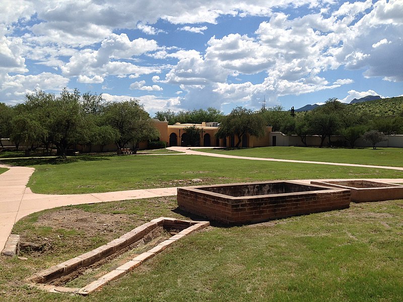
English: three rectangular brick structures aligned in a row, visitor center in background Unknown water-related feature
|
|||
| Depicted place |
English: Tumacacori National Historical Park, Santa Cruz County, Arizona |
|||
| Date | Taken on 13 August 2015 | |||
| Accession number | ||||
| Source |
English: NPGallery |
|||
| Permission (Reusing this file) |
|
|||
| NPS Unit Code | TUMA | |||
| Album(s) | English: Unknown water-related feature |
|||
File history
Click on a date/time to view the file as it appeared at that time.
| Date/Time | Thumbnail | Dimensions | User | Comment | |
|---|---|---|---|---|---|
| current | 01:53, 19 May 2021 | | 3,264 × 2,448 (2.94 MB) | BMacZeroBot (talk | contribs) | Batch upload (Commons:Batch uploading/NPGallery) |
You cannot overwrite this file.
File usage on Commons
The following page uses this file:
.JPG)
.JPG&oldid=767998099)