File:United States of Nth. America = Carte des Etats-Unis de L'Amerique Septentrionale LOC 98685633.jpg
Jump to navigation
Jump to search

Size of this preview: 680 × 599 pixels. Other resolutions: 272 × 240 pixels | 545 × 480 pixels | 872 × 768 pixels | 1,162 × 1,024 pixels | 2,324 × 2,048 pixels | 17,173 × 15,132 pixels.
Original file (17,173 × 15,132 pixels, file size: 41.01 MB, MIME type: image/jpeg)
Captions
Captions
Add a one-line explanation of what this file represents
Summary[edit]
| Warning | The original file is very high-resolution. It might not load properly or could cause your browser to freeze when opened at full size. |
|---|
| Description |
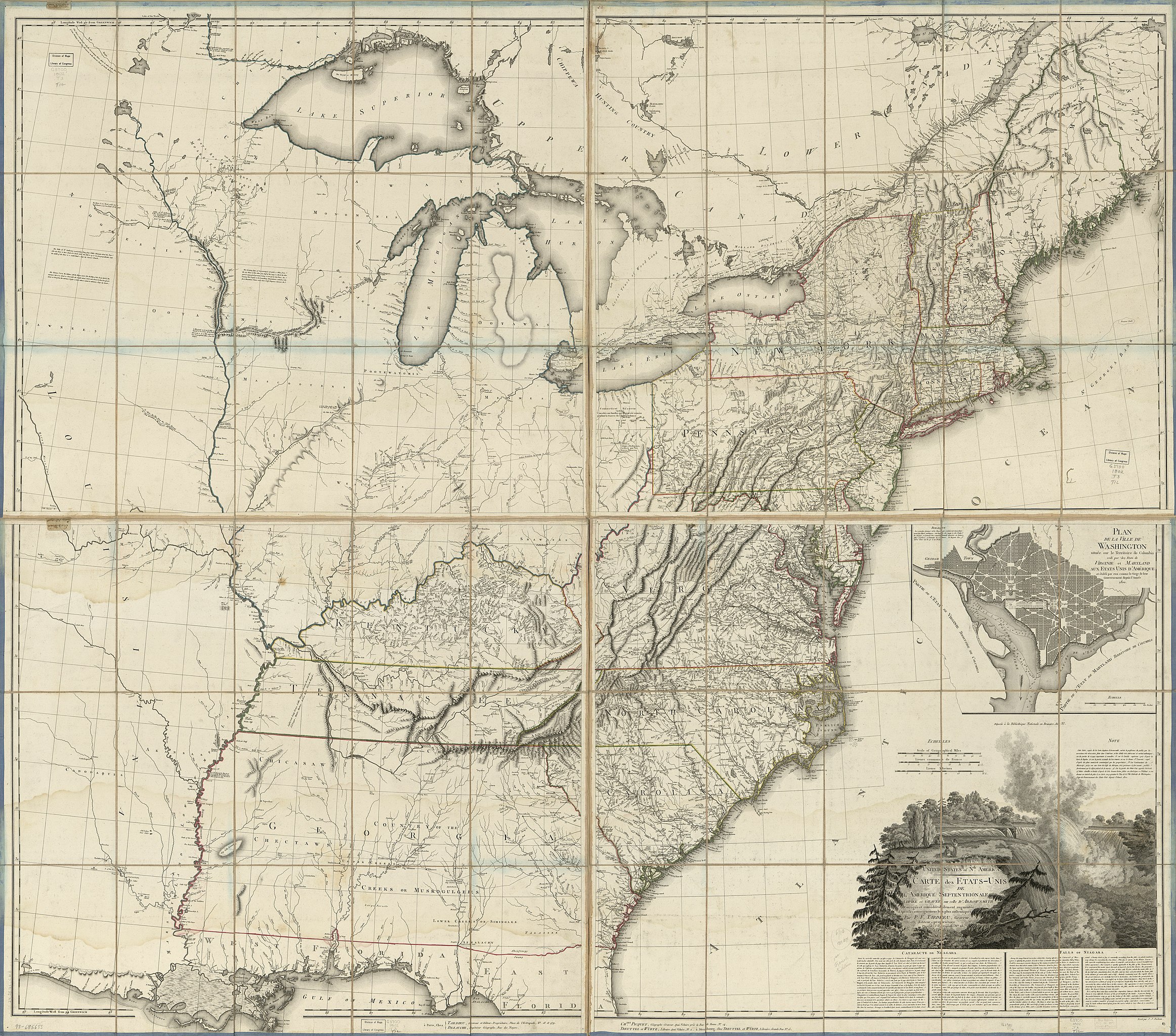
English: Relief shown by hachures. Includes text, illustrations, and inset "Plan de la ville de Washington située sur le Territoire de Columbia, cedé par les etats de Virginie et Maryland aux Etats Unis d'Amérique et établi par eux comme le siege de leur gouvernement depuis l'année 1800." LC copy has each sheet sectioned into 15 and mounted on cloth. Each sheet has on upper right verso a label from "Chez Picquet géographe-graveur". Available also through the Library of Congress Web site as a raster image. English. Some text in both English and French, some text in only English or French. |
||
| Title | United States of Nth. America = Carte des Etats-Unis de L'Amerique Septentrionale | ||
| Shelf ID | G3700 1802 .T3 | ||
| Date | |||
| Source | https://www.loc.gov/item/98685633/ | ||
| Author | Tardieu, Pierre Alexandre; Arrowsmith, Aaron | ||
| Permission (Reusing this file) |
|
||
| Location | United States · United States. | ||
| Part of | American Memory · General Maps · Catalog · Geography And Map Division | ||
| Subject | United States · Maps |

Licensing[edit]
|
This is a faithful photographic reproduction of a two-dimensional, public domain work of art. The work of art itself is in the public domain for the following reason:
The official position taken by the Wikimedia Foundation is that "faithful reproductions of two-dimensional public domain works of art are public domain".
This photographic reproduction is therefore also considered to be in the public domain in the United States. In other jurisdictions, re-use of this content may be restricted; see Reuse of PD-Art photographs for details. | ||||
File history
Click on a date/time to view the file as it appeared at that time.
| Date/Time | Thumbnail | Dimensions | User | Comment | |
|---|---|---|---|---|---|
| current | 19:52, 10 January 2019 | | 17,173 × 15,132 (41.01 MB) | Fæ (talk | contribs) | LOC Maps https://www.loc.gov/item/98685633/ #3518 |
You cannot overwrite this file.
File usage on Commons
There are no pages that use this file.