File:Ug-map.png
Jump to navigation
Jump to search
No higher resolution available.
Ug-map.png (330 × 354 pixels, file size: 56 KB, MIME type: image/png)
Captions
Captions
Add a one-line explanation of what this file represents
Summary[edit]
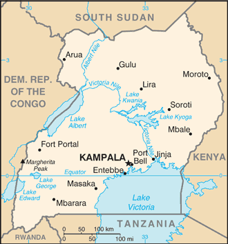
| Description | Uganda map from CIA World Factbook, converted from original GIF format (July 2011 version showing South Sudan) |
| Date | |
| Source |
CIA World Factbook |
| Author | United States Central Intelligence Agency |
| Other versions |
|
Licensing[edit]
This image is in the public domain because it contains materials that originally came from the United States Central Intelligence Agency's World Factbook.
|
 |
Derivative works[edit]
Derivatives of 2002 map (not showing South Sudan):


File history
Click on a date/time to view the file as it appeared at that time.
| Date/Time | Thumbnail | Dimensions | User | Comment | |
|---|---|---|---|---|---|
| current | 00:06, 13 July 2011 | | 330 × 354 (56 KB) | Béka~commonswiki (talk | contribs) | new version with South Sudan, from CIA |
| 22:47, 11 June 2005 |  | 330 × 355 (12 KB) | Dubaduba~commonswiki (talk | contribs) | {{PD-USGov-CIA-WF}} |
You cannot overwrite this file.
File usage on Commons
The following 6 pages use this file:
File usage on other wikis
The following other wikis use this file:
- Usage on azb.wikipedia.org
- Usage on dag.wikipedia.org
- Usage on da.wikipedia.org
- Usage on dsb.wikipedia.org
- Usage on en.wikipedia.org
- List of cities and towns in Uganda
- List of airports in Uganda
- Payment for ecosystem services
- FUFA Big League
- User:Scarlson0921/sandbox
- Youth in Uganda
- 2012–13 Uganda Super League
- 2013–14 Uganda Super League
- 2009–10 Uganda Big League
- 2014–15 Uganda Super League
- User:Bshenouda/sandbox
- 2017 Uganda Marburg virus outbreak
- Usage on en.wikinews.org
- Usage on es.wikipedia.org
- Usage on eu.wikipedia.org
- Usage on fa.wikipedia.org
- Usage on fi.wikipedia.org
- Usage on fr.wikipedia.org
- Usage on gag.wikipedia.org
- Usage on ga.wikipedia.org
- Usage on gd.wikipedia.org
- Usage on gl.wikipedia.org
- Usage on hu.wikipedia.org
- Usage on hu.wiktionary.org
- Usage on id.wikipedia.org
- Usage on incubator.wikimedia.org
- Usage on it.wikipedia.org
- Usage on ja.wikipedia.org
View more global usage of this file.