File:US initiatives, referenda map.jpg
Jump to navigation
Jump to search
No higher resolution available.
US_initiatives,_referenda_map.jpg (711 × 428 pixels, file size: 37 KB, MIME type: image/jpeg)
Captions
Captions
Add a one-line explanation of what this file represents

|
File:US initiatives, referenda map.svg is a vector version of this file. It should be used in place of this JPG file when not inferior.
File:US initiatives, referenda map.jpg → File:US initiatives, referenda map.svg
For more information, see Help:SVG. |
 |


Summary[edit]
| Description |
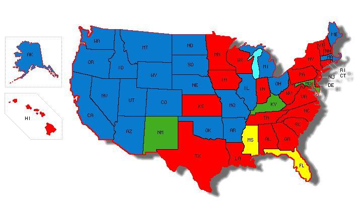
English: Map showing which states have initiatives, referenda, and which states don't.
|
| Source | Own work |
| Author | Intervals |
Licensing[edit]
| I, the copyright holder of this work, release this work into the public domain. This applies worldwide. In some countries this may not be legally possible; if so: I grant anyone the right to use this work for any purpose, without any conditions, unless such conditions are required by law. |
File history
Click on a date/time to view the file as it appeared at that time.
| Date/Time | Thumbnail | Dimensions | User | Comment | |
|---|---|---|---|---|---|
| current | 00:46, 15 June 2009 | | 711 × 428 (37 KB) | Intervals (talk | contribs) | {{Information |Description={{en|1=Map showing which states have initiatives, referenda, and which states don't.}} |Source=Own work by uploader |Author=Intervals |Date= |Permission= |other_versions= }} <!--{{ImageUpload|full}}--> |
You cannot overwrite this file.
File usage on Commons
The following page uses this file:
- File:I&rmap.JPG (file redirect)
File usage on other wikis
The following other wikis use this file:
- Usage on ca.wikipedia.org