File:US 131, M-6, 68th St interchange.jpg
Jump to navigation
Jump to search

Size of this preview: 800 × 533 pixels. Other resolutions: 320 × 213 pixels | 640 × 427 pixels | 1,024 × 683 pixels | 1,280 × 853 pixels | 2,560 × 1,707 pixels | 3,072 × 2,048 pixels.
Original file (3,072 × 2,048 pixels, file size: 1.88 MB, MIME type: image/jpeg)
Captions
Captions
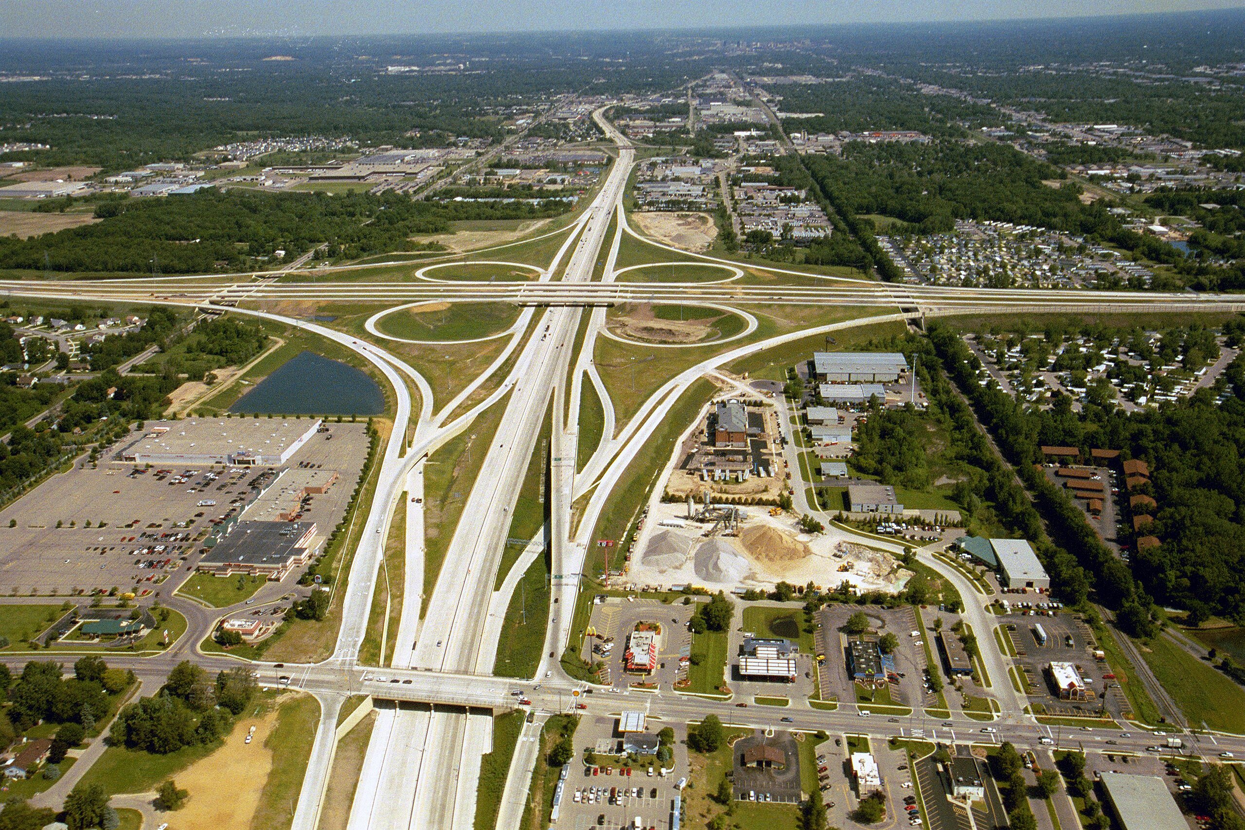
Aerial photo of the US 131/M-6/68th Street interchange in Wyoming, Michigan looking north.
Summary[edit]
| Description | |
| Date | |
| Source | Michigan Department of Transportation |
| Author | Michigan Department of Transportation |
| Permission (Reusing this file) |
| Camera location | | View this and other nearby images on: OpenStreetMap |
|---|
| Object location | | View this and other nearby images on: OpenStreetMap |
|---|
Licensing[edit]
| This work has been released into the public domain by its author, Michigan Department of Transportation. This applies worldwide. In some countries this may not be legally possible; if so: Michigan Department of Transportation grants anyone the right to use this work for any purpose, without any conditions, unless such conditions are required by law.
|
File history
Click on a date/time to view the file as it appeared at that time.
| Date/Time | Thumbnail | Dimensions | User | Comment | |
|---|---|---|---|---|---|
| current | 22:31, 14 December 2010 | | 3,072 × 2,048 (1.88 MB) | Imzadi1979 (talk | contribs) | {{Information |Description=Aerial photo of the US 131/M-6/68th St. interchange in Wyoming, MIchigan |Source=w:Michigan Department of Transportation |Date=June 2004 |Author= |
You cannot overwrite this file.
File usage on Commons
The following page uses this file:
File usage on other wikis
The following other wikis use this file:
- Usage on bn.wikipedia.org
- Usage on en.wikipedia.org
- Usage on en.wikiquote.org
- Usage on en.wiktionary.org
- Usage on eo.wiktionary.org
- Usage on hi.wikipedia.org
- Usage on io.wikipedia.org
- Usage on ja.wikipedia.org
- Usage on mk.wikipedia.org
- Usage on ms.wikipedia.org
- Usage on new.wikipedia.org
- Usage on pl.wikipedia.org
- Usage on pt.wikipedia.org
- Usage on shn.wiktionary.org
- Usage on sr.wikipedia.org
- Usage on sw.wikipedia.org
- Usage on ta.wikipedia.org
- Usage on th.wikipedia.org
- Usage on th.wiktionary.org
- Usage on tl.wikipedia.org
- Usage on uk.wikipedia.org
Metadata
Categories:
- Cityscapes of Grand Rapids, Michigan
- U.S. Route 131 in Michigan
- M-6 (Michigan highway)
- Girder bridges in Michigan
- Aerial photographs of interchanges in Michigan
- June 2004 in Michigan
- 2000s bridges in Michigan
- Built in Michigan in 2000
- Bridges in the United States completed in 2000
- Bridges over railway lines in Michigan
- Bridges on U.S. Route 131
- Prestressed concrete beam bridges
- Cloverleaf interchanges
- 2004 aerial photographs of the United States